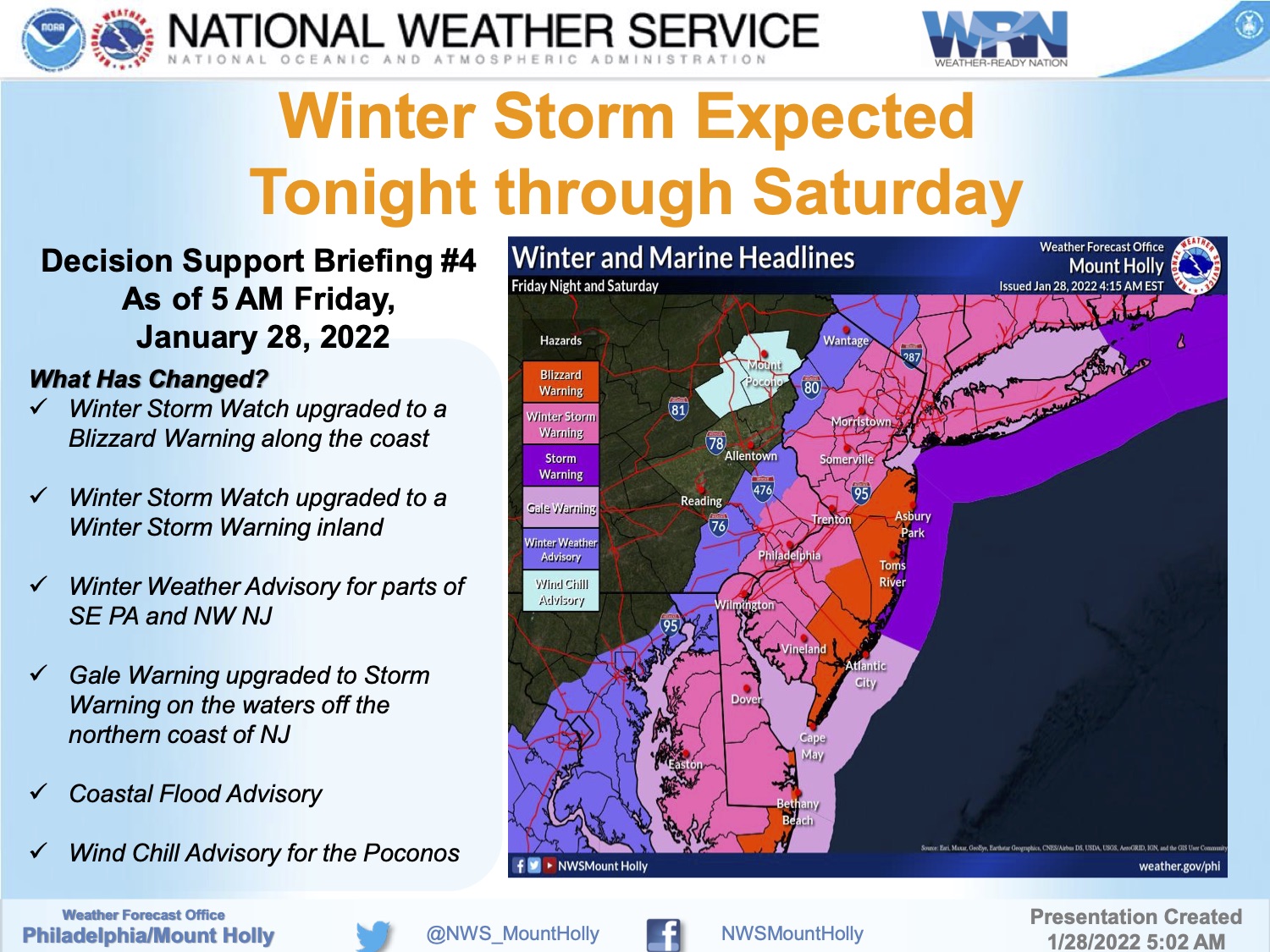
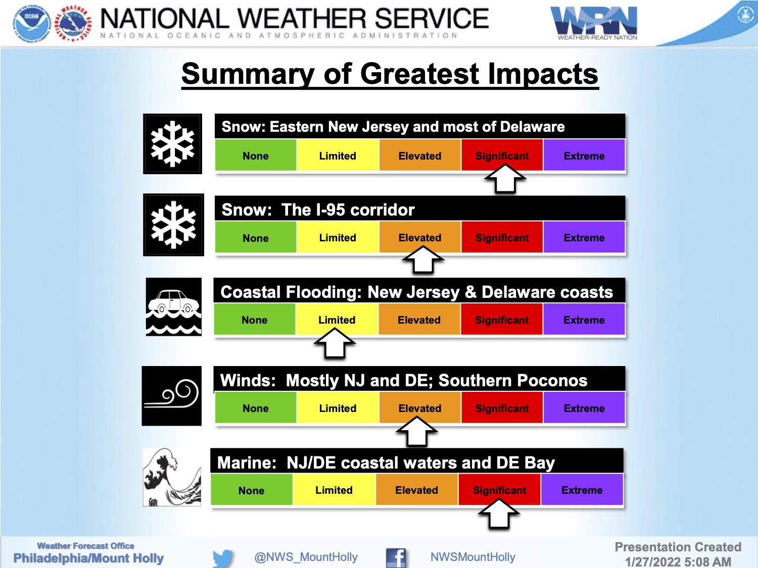
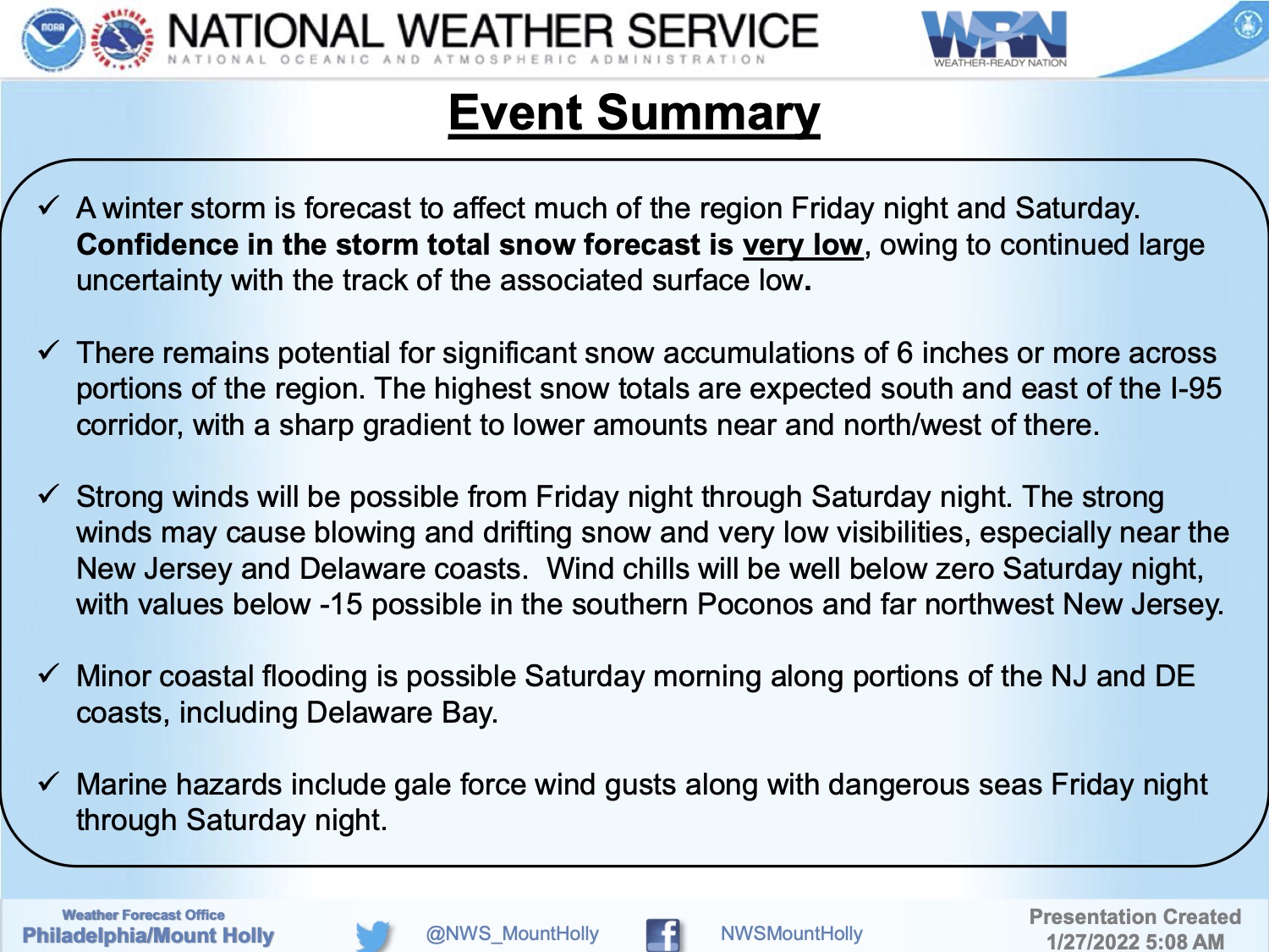
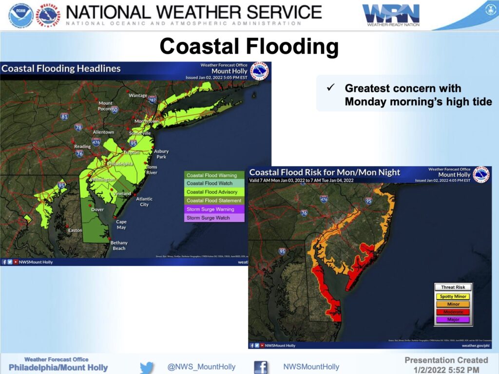
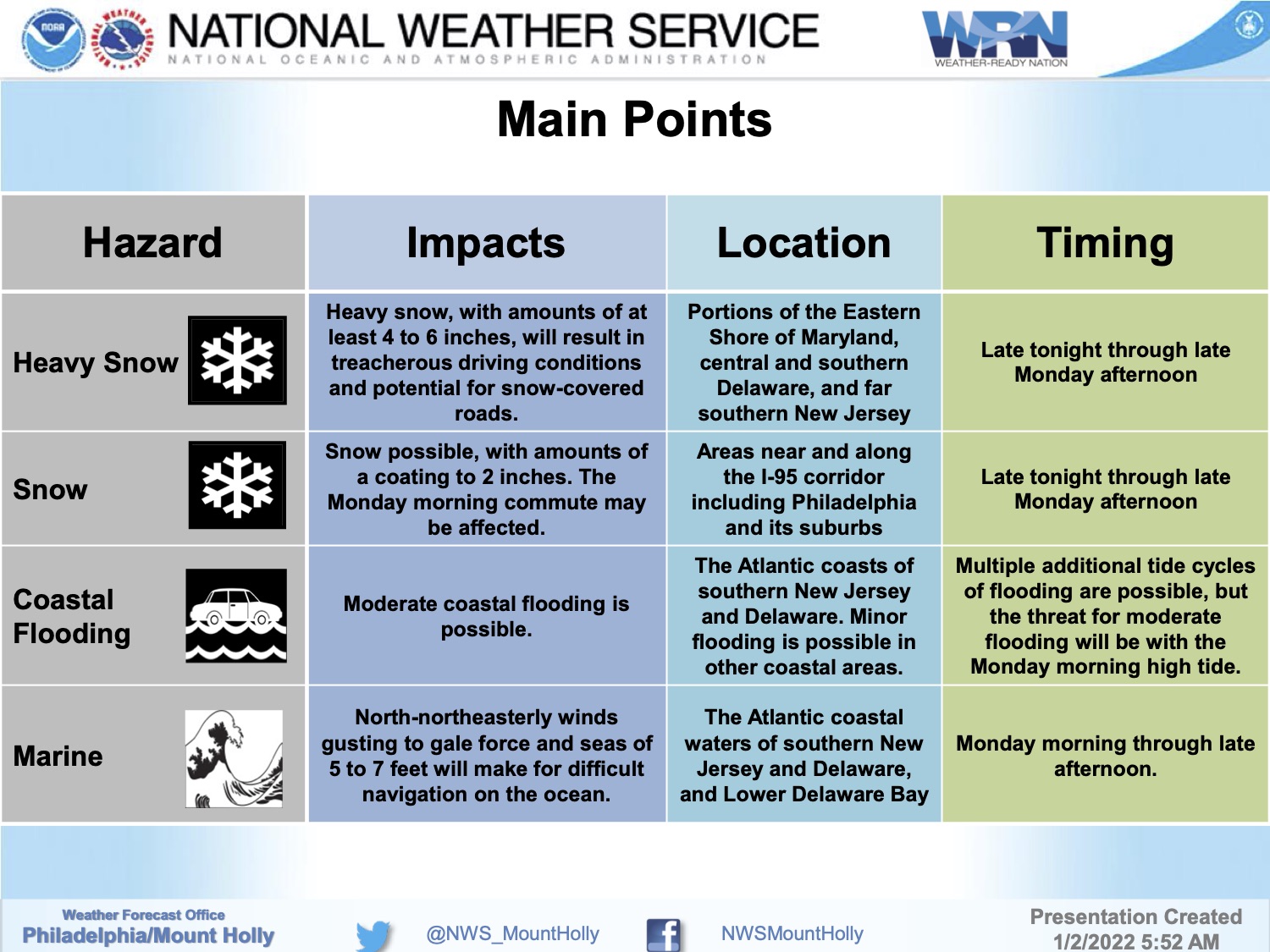
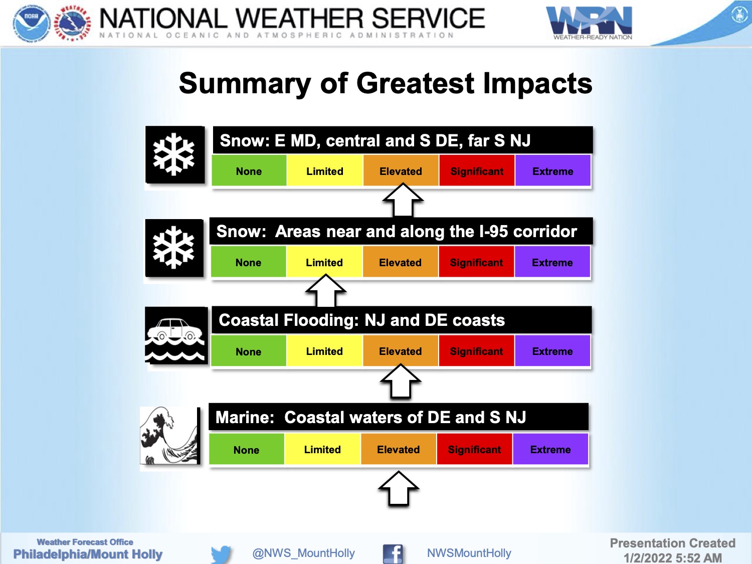
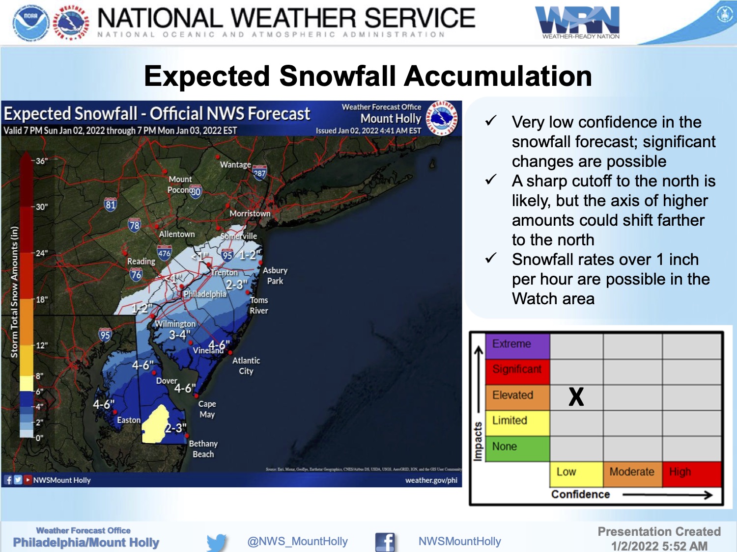
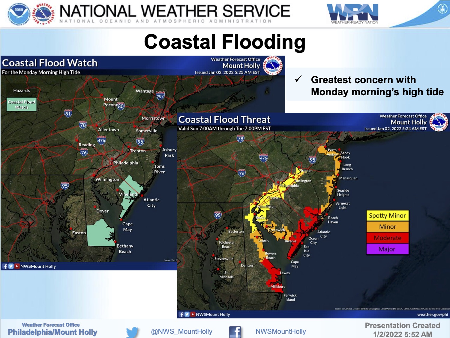
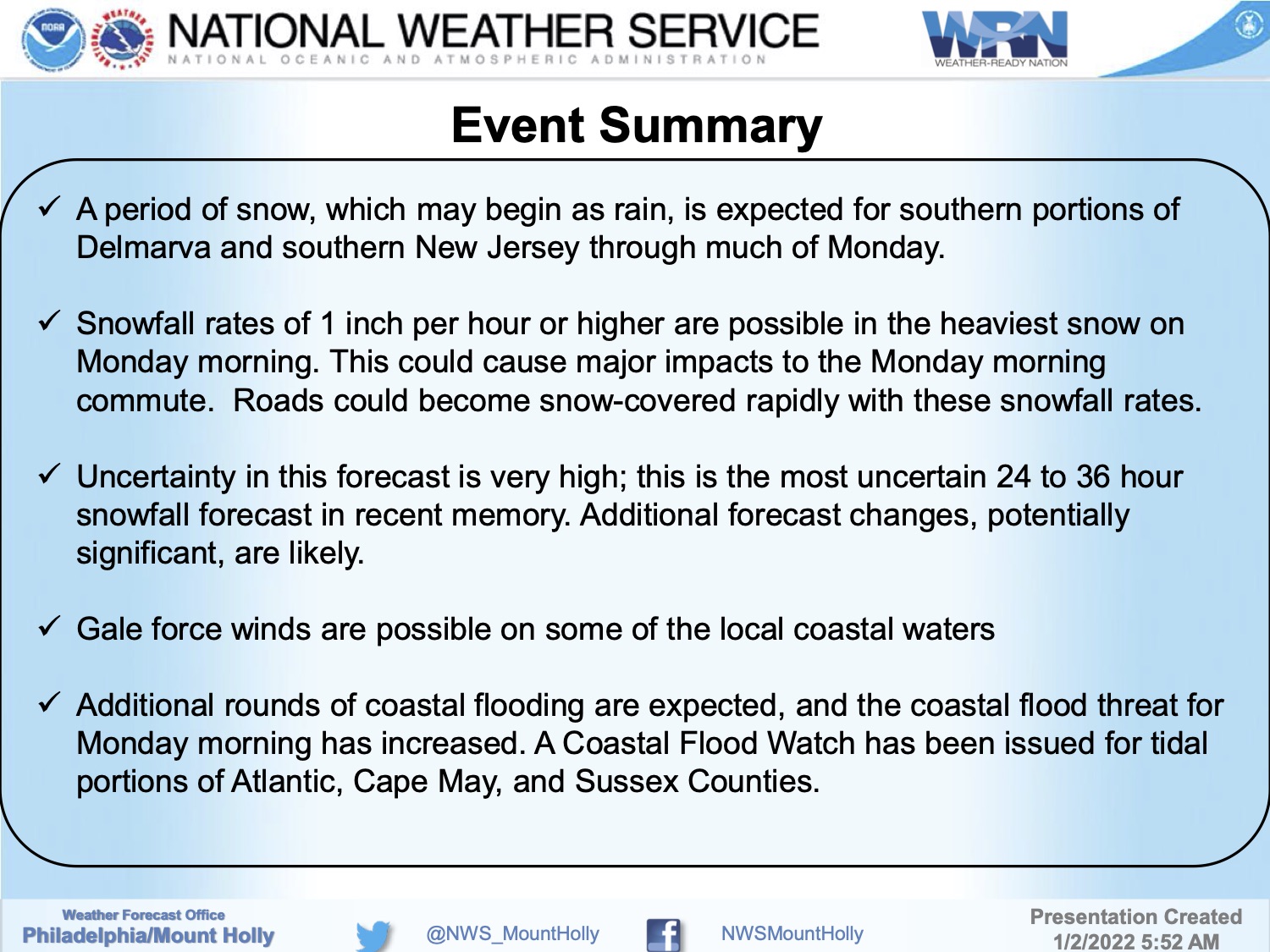
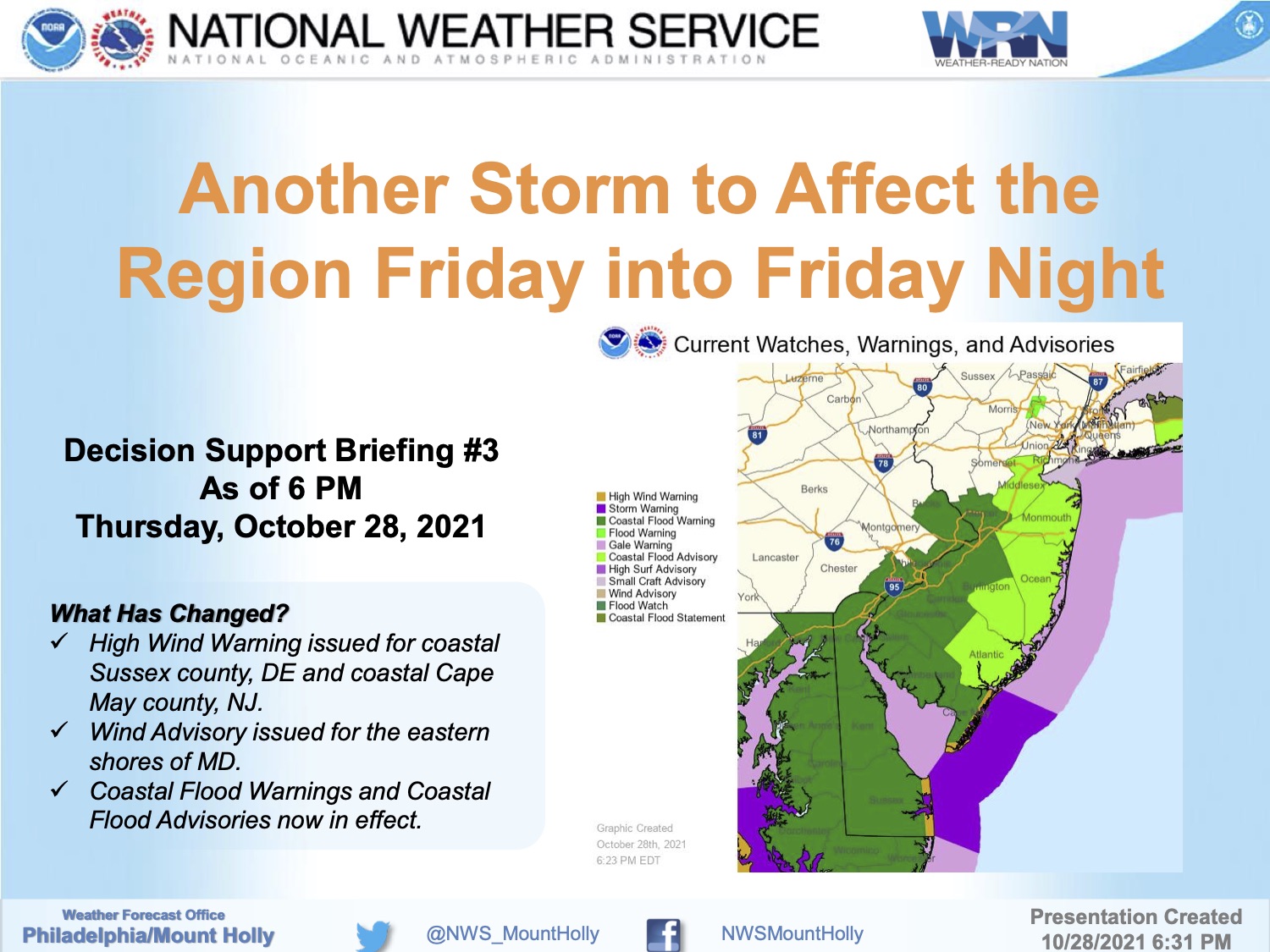
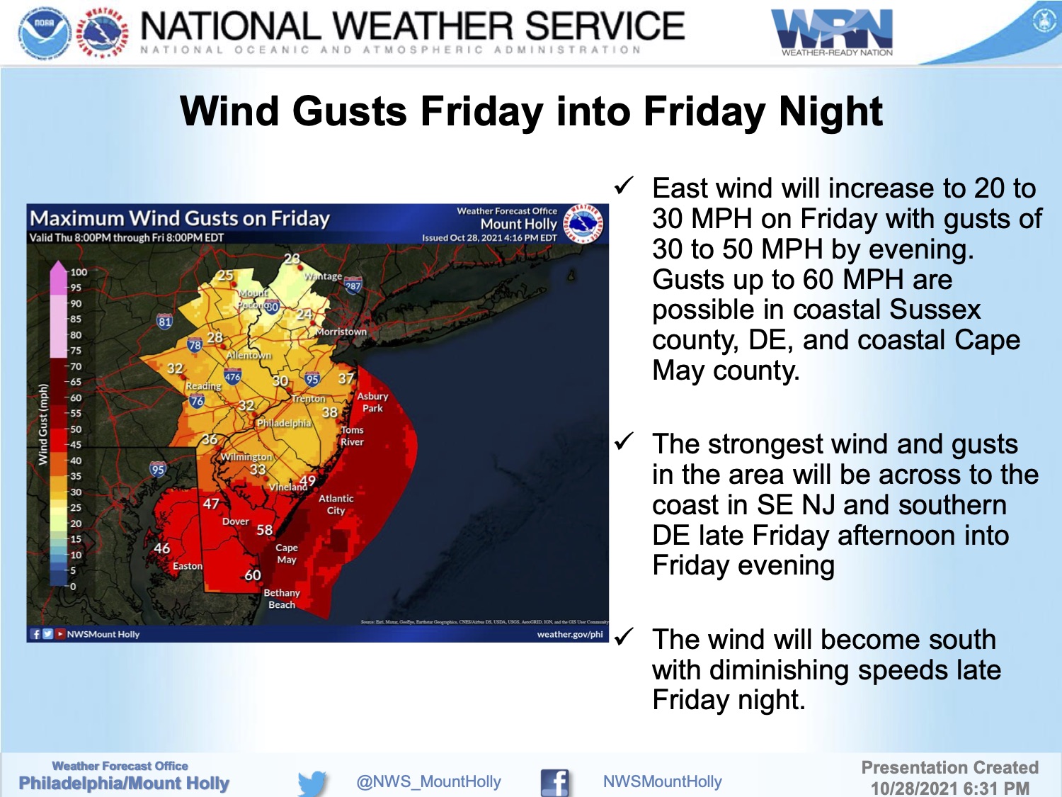
Friday, January 28th, 7:10am: Blizzard Warning for Stone Harbor; Strong Winds, Heavy Snow Expected
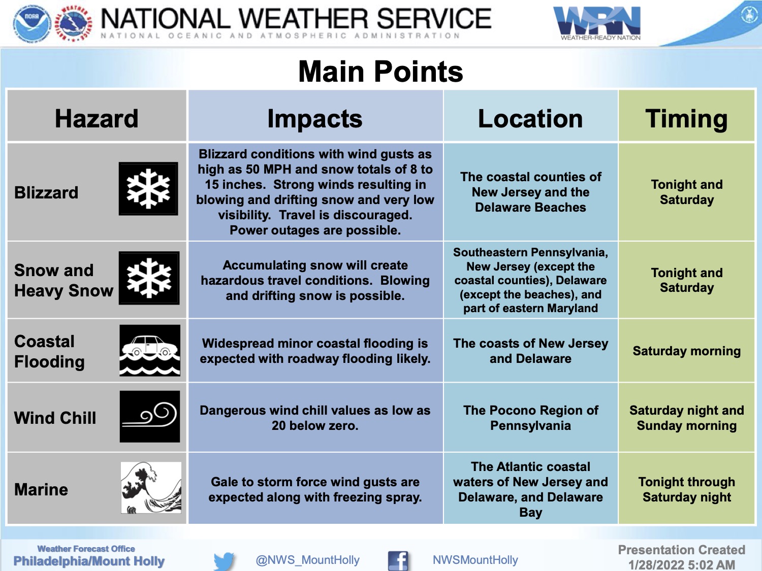
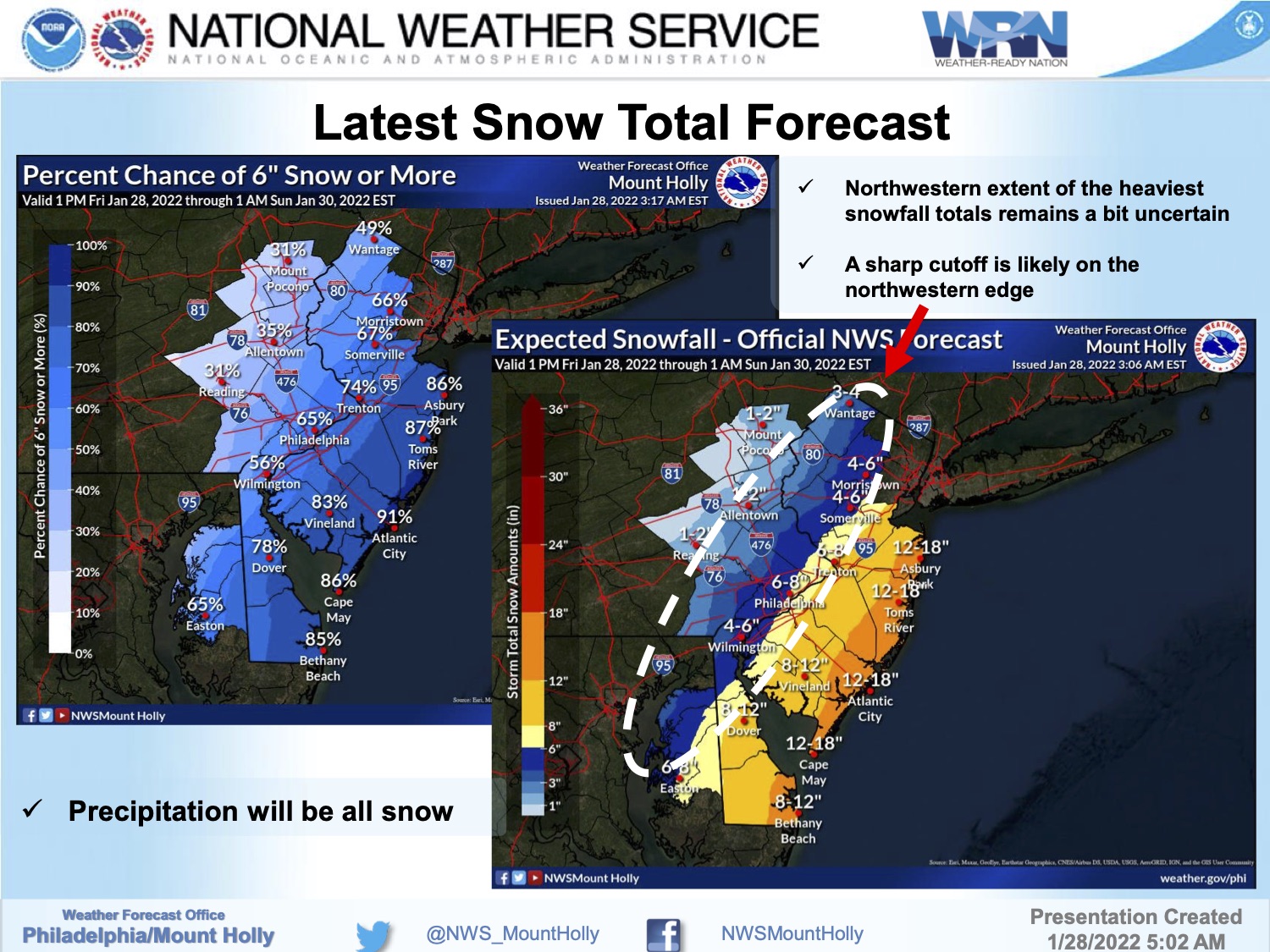
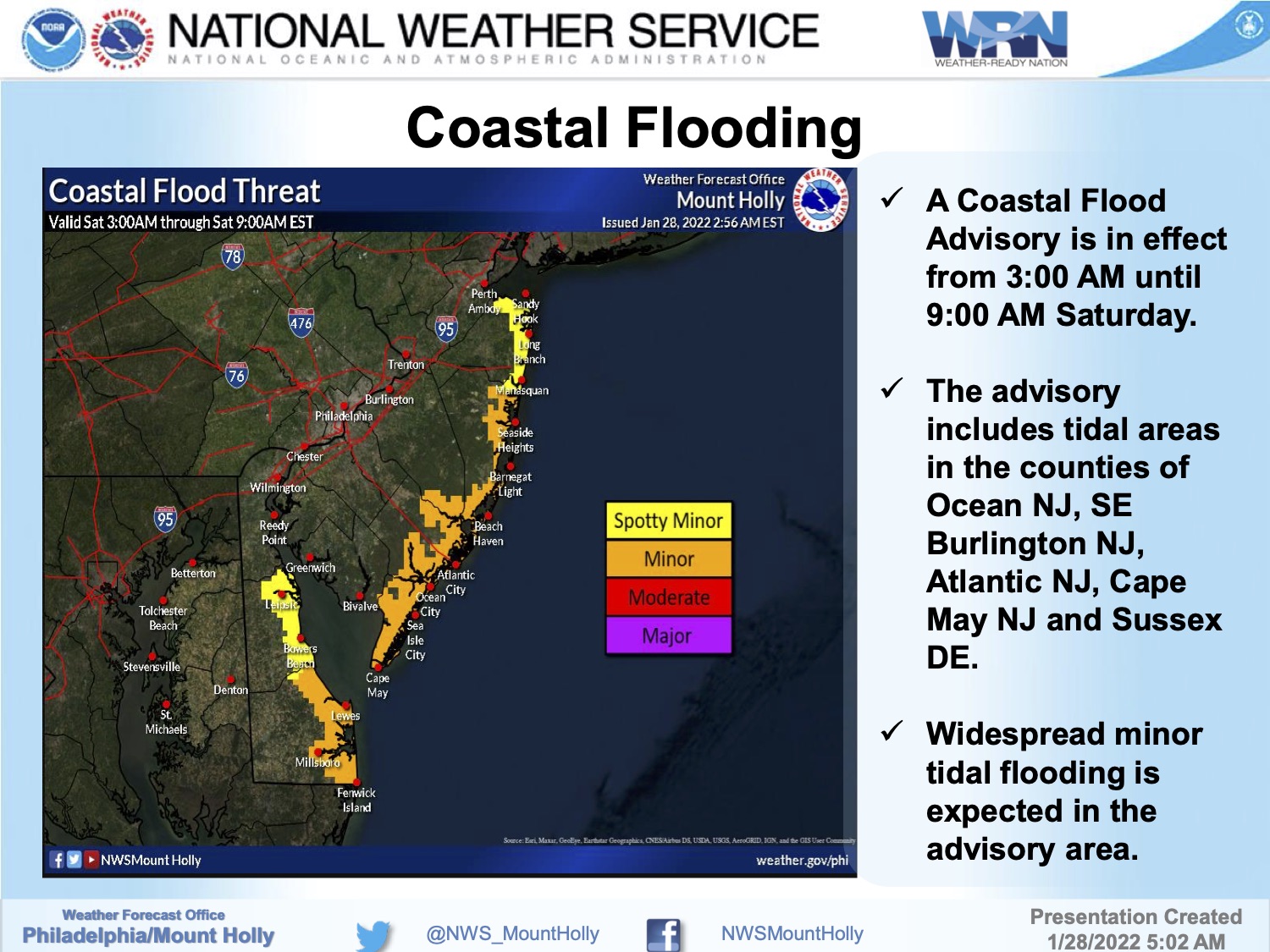
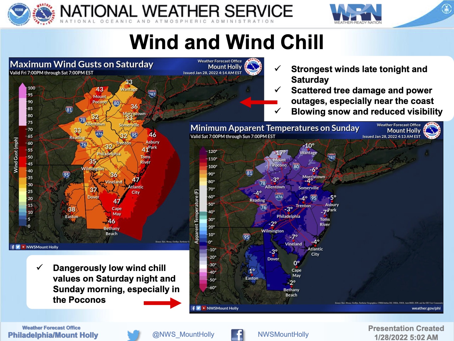
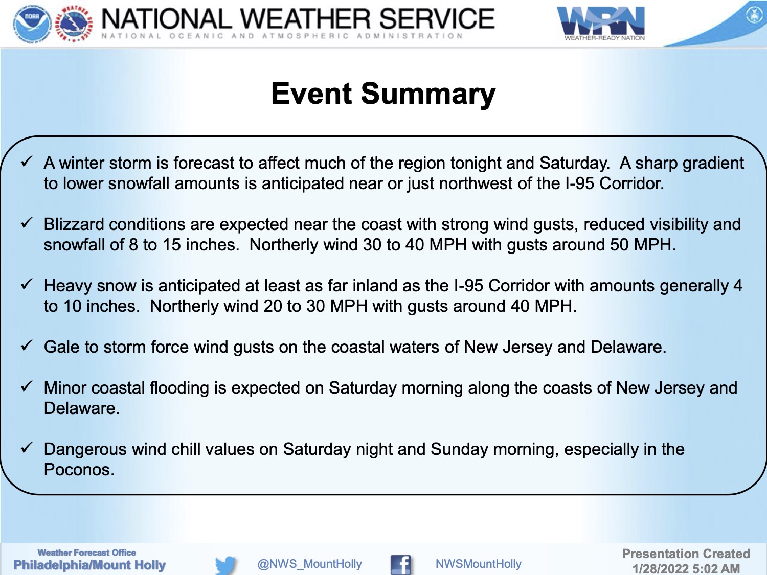
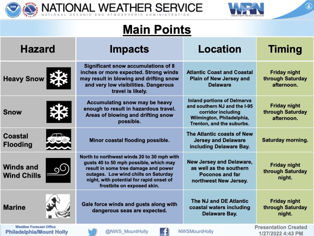
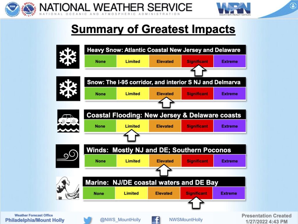
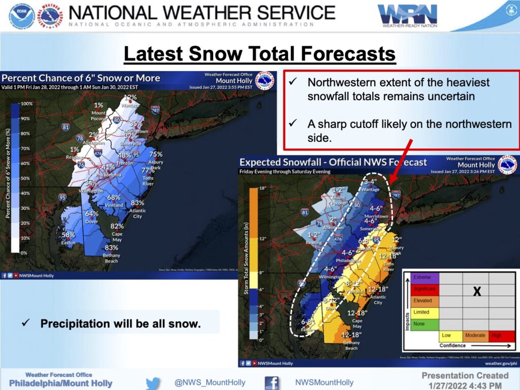
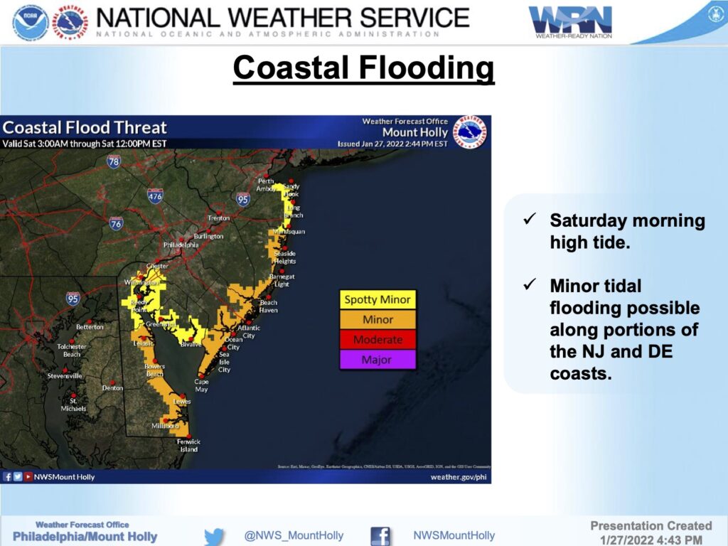
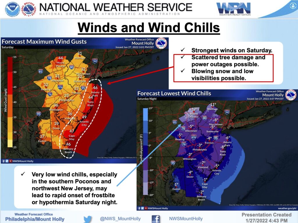
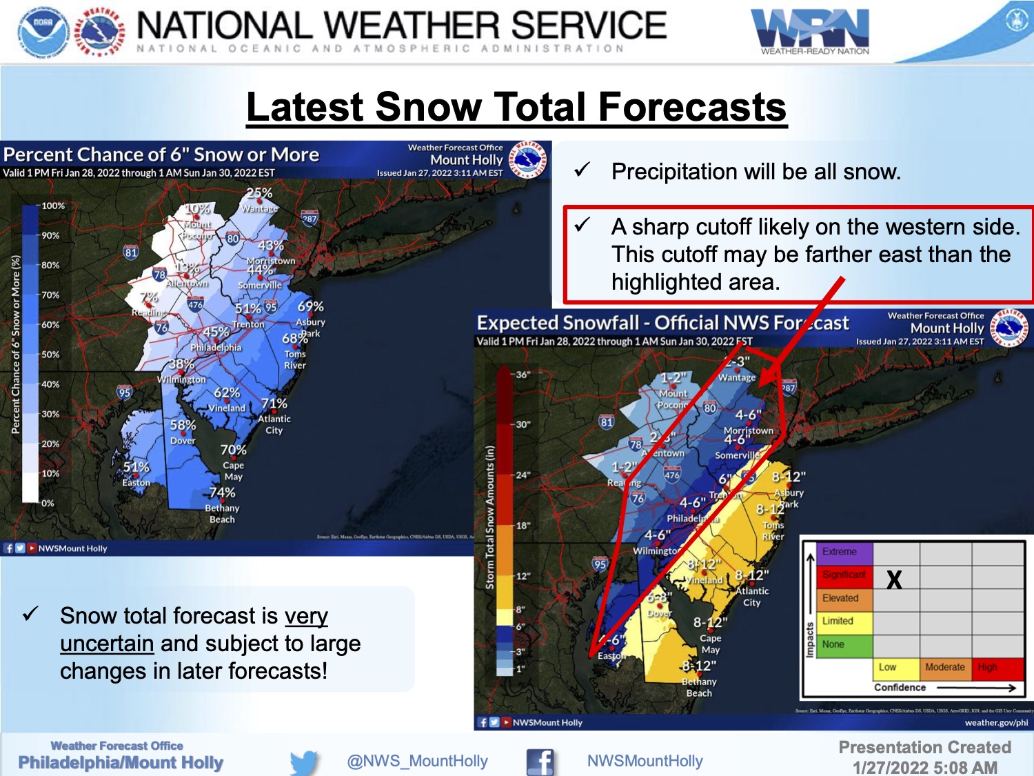
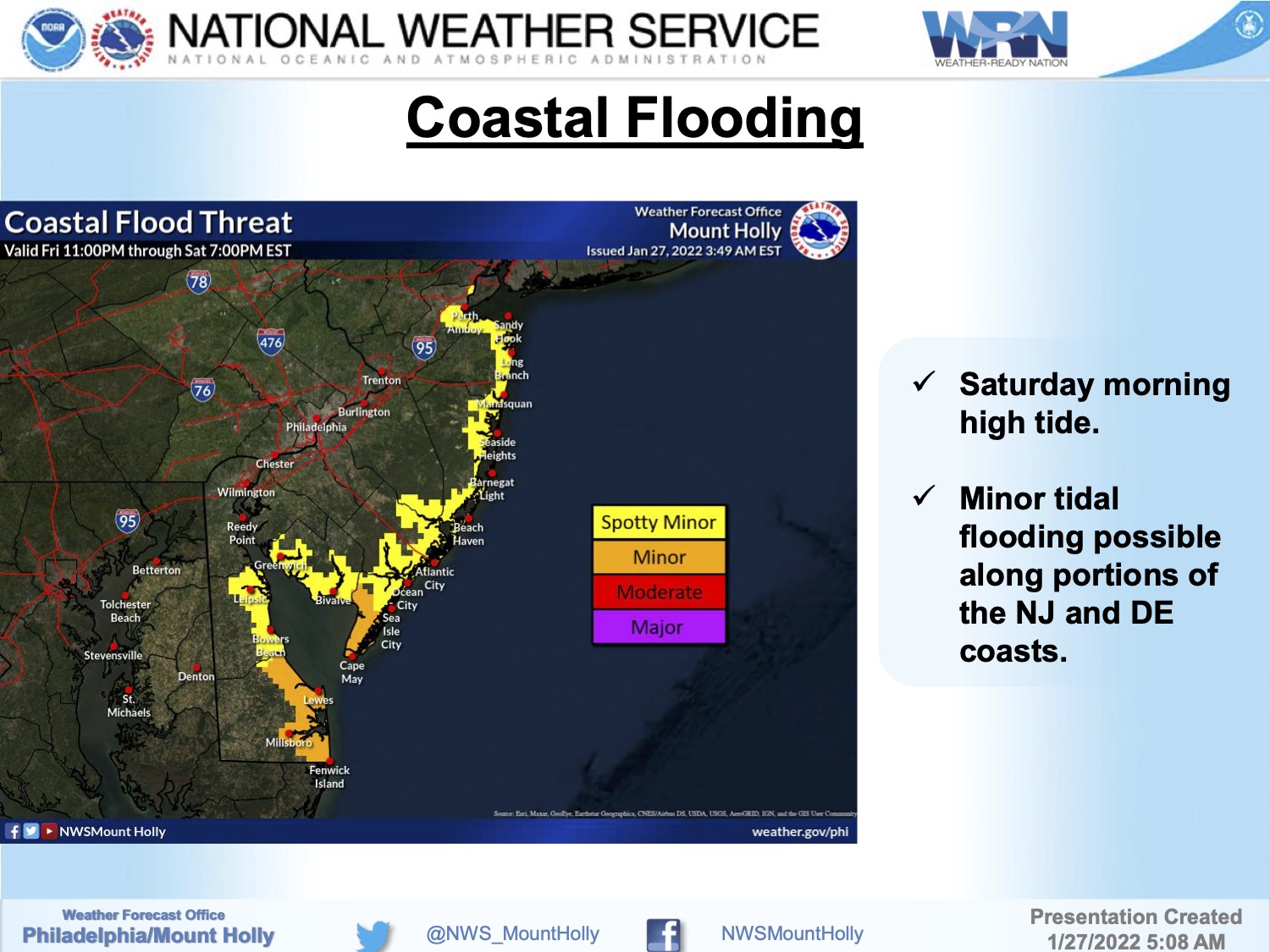
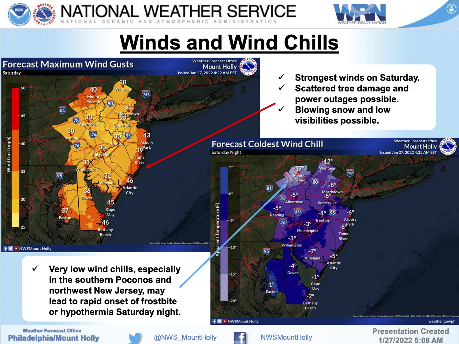
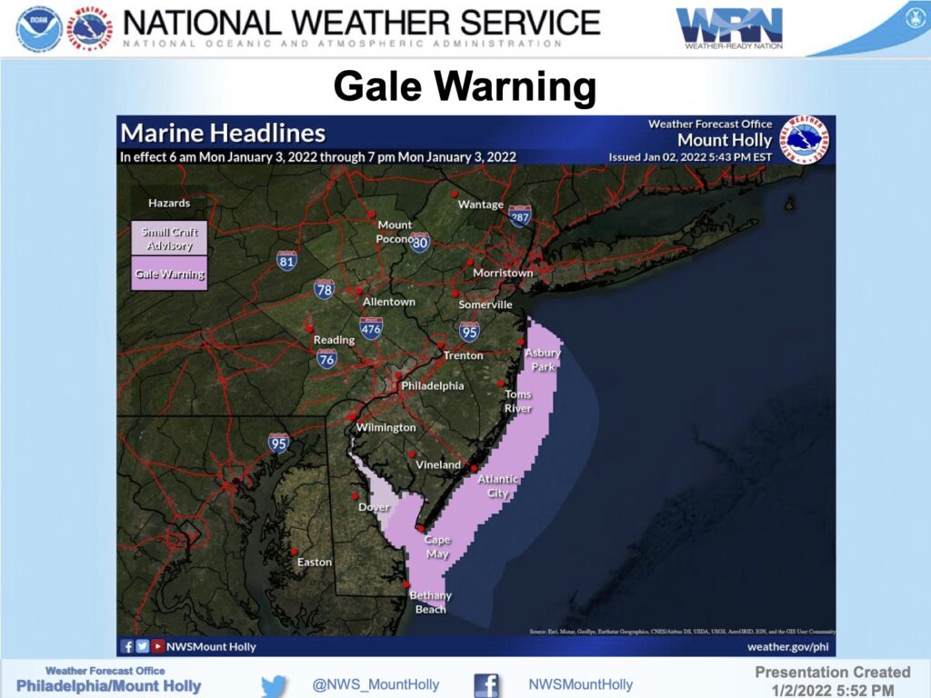
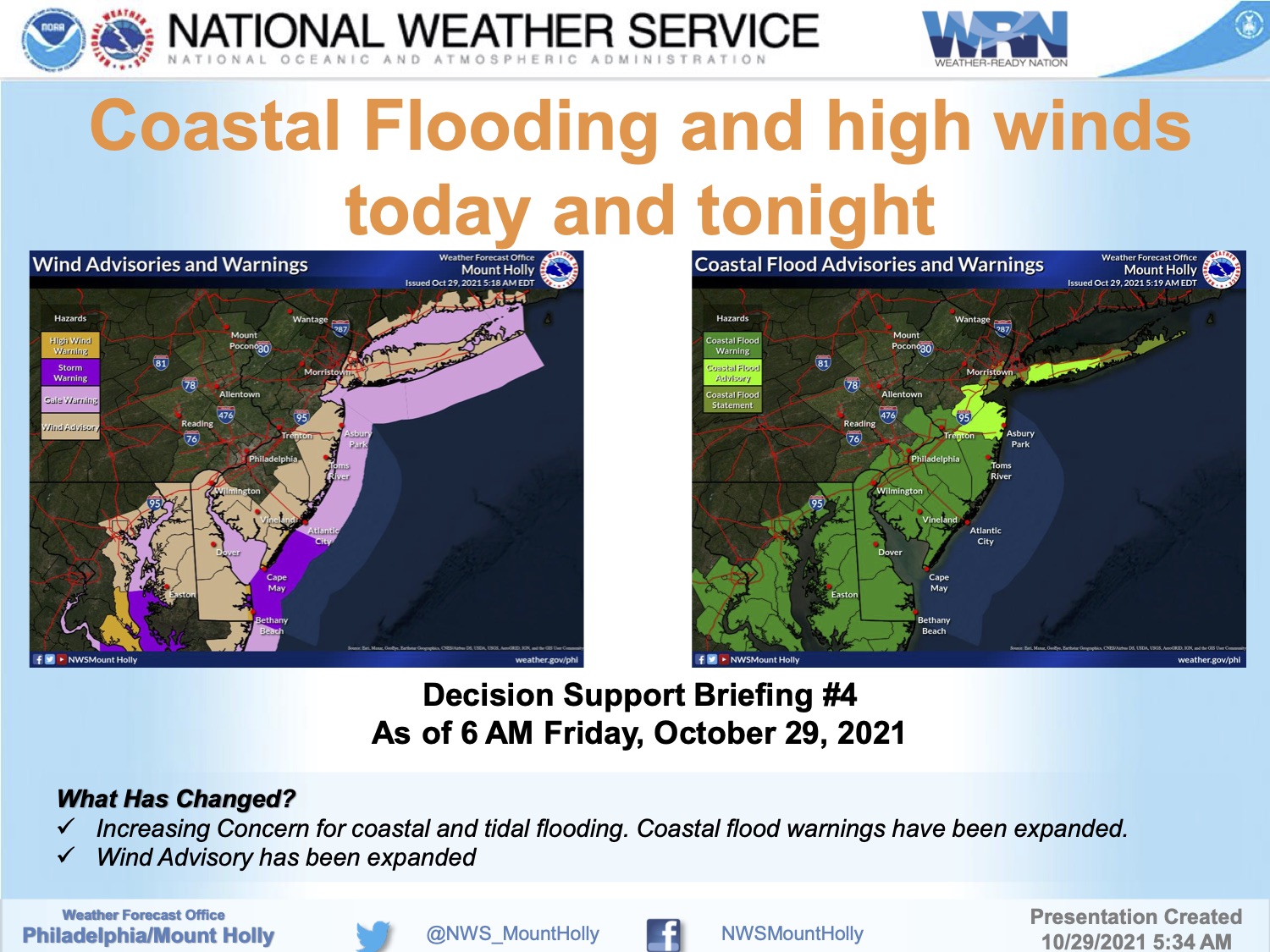
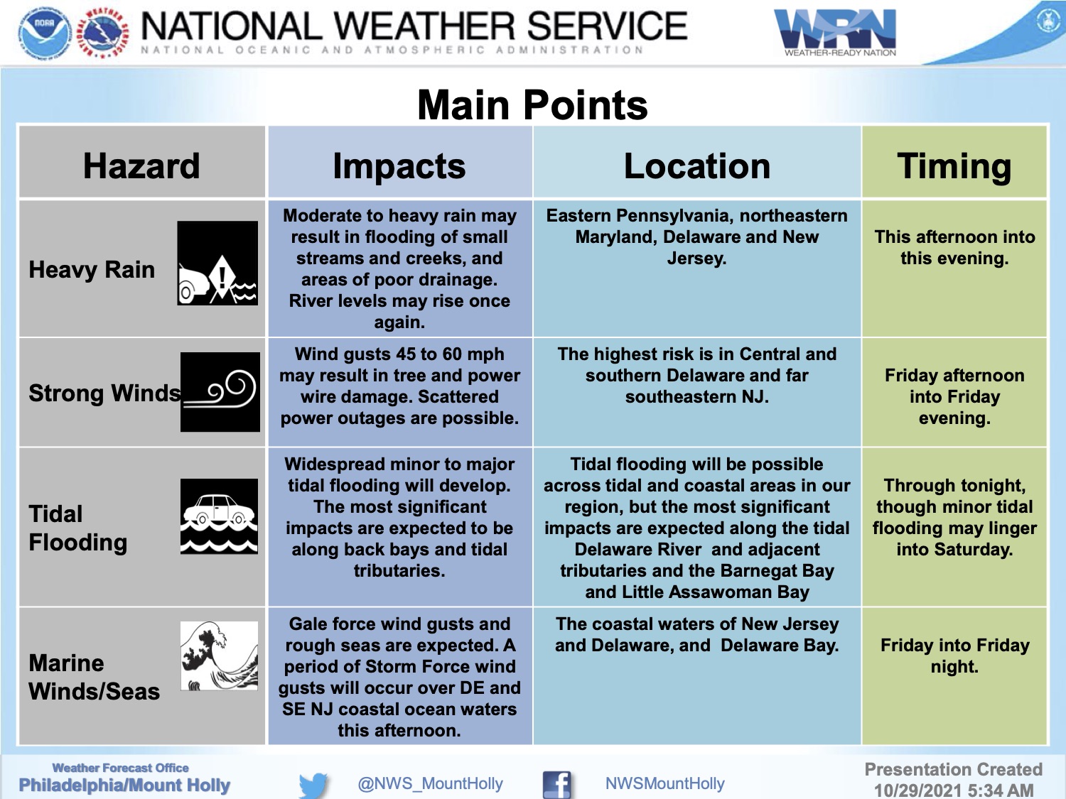
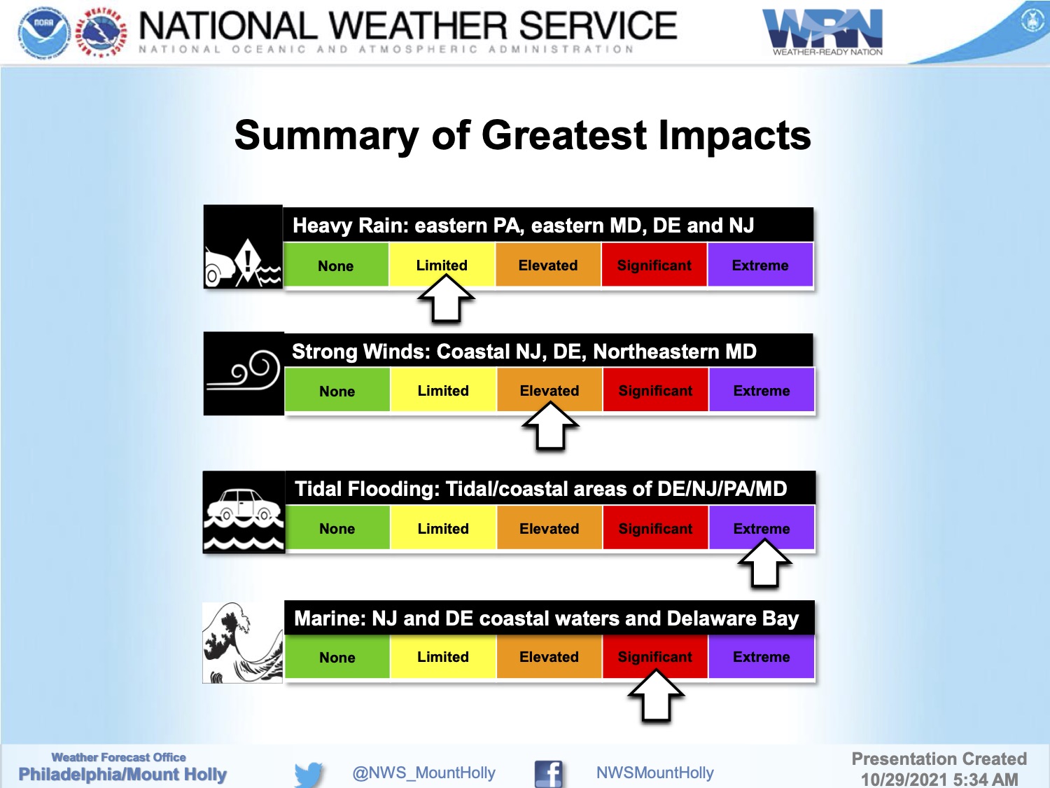
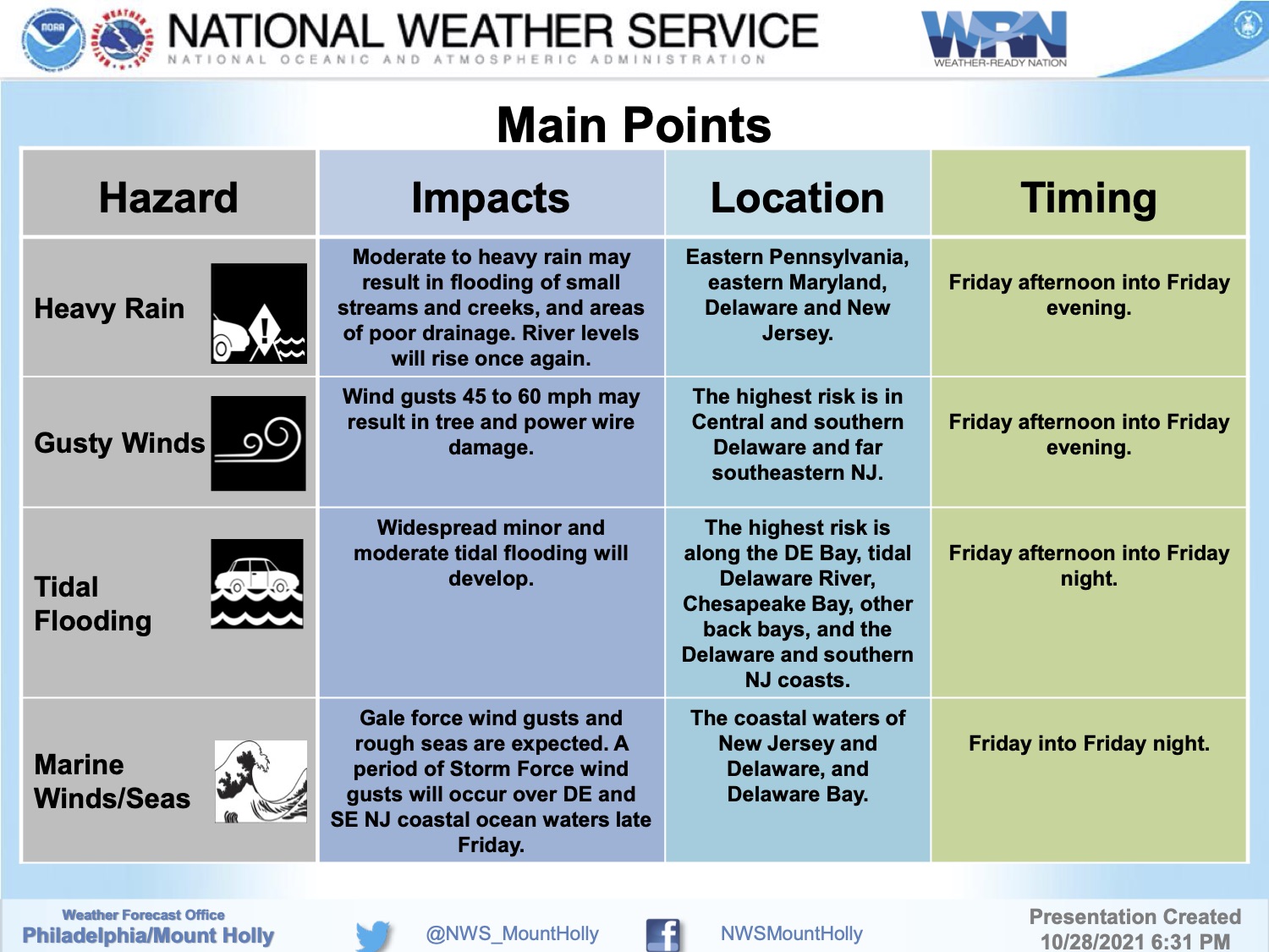
The National Weather Service has issued a Blizzard Warning for the southern New Jersey coastline. The Warning is in effect from Friday, January 28th at 7pm until Saturday, January 29th, at 7pm. Blizzard conditions are expected with wind gusts approaching 50mph and the potential for 8-15” of snowfall. A Coastal Flood Advisory is in effect on Saturday from 3am until 9am; minor tidal flooding is expected.
Travel conditions will be difficult to impossible during this storm event. Driving late Friday night through Saturday is not recommended. Snow is expected to end at some point Saturday afternoon.
Contractors are required to secure their job sites before they stop work for the day on Friday. Consider securing objects on your property that are prone to strong winds. Beach erosion is likely during this storm event. If you have any emergency, dial 911. If you experience a power outage, please call Atlantic City Electric directly at 1-800-833-7476.