Mon, Feb. 8th, 5:05pm: Winter Storm Warning, Coastal Flood Warning For Stone Harbor

winter_storm_warning

The National Weather Service has again revised the forecast for our Borough. As of late Monday afternoon, a Winter Storm Warning has been added to the Coastal Flood Warning for our community. The potential now exists for widespread moderate coastal flooding and the possibility of between three to six inches of snow during a storm event Monday night through the day on Tuesday.

Snow is expected to develop during the overnight hours into Tuesday morning, and snow will continue until Tuesday evening. Accumulating snow is expected to affect some travel in our region during the next 24 hours. Please exercise caution while driving.

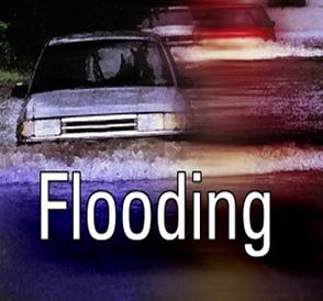
The Coastal Flood Warning is in effect through Tuesday at 12 Noon. High tide will occur at the Townsend’s Inlet Bridge between Avalon and Sea Isle City on Monday at 7:54pm, and again on Tuesday morning at 8:16am. Areas of Avalon that typically experience flooding during coastal storm events will likely see flood water during these two high tides.

Never attempt to drive on any flooded street as it puts you and your vehicle in danger; driving on a flooded street also creates an unnecessary wake that can damage businesses and residential properties. Never park on any bridge in our community. Please consider moving your car to higher ground in advance of the next two high tide events. If you have any emergency, dial 911. If you experience a power outage, call Atlantic City Electric’s outage number at 1-800-833-7476.

Continue to monitor traditional media outlets for updates on this weather forecast.

Mon, Feb. 8th, 5:05pm: Winter Storm Warning, Coastal Flood Warning For Stone Harbor2016-02-08T22:07:03-05:00

Mon, Feb. 8th, 2:55pm: Coastal Flood Warning Posted for Stone Harbor

Flooding

The National Weather Service has issued a Coastal Flood Warning for the Borough.  The Warning is in effect for the Borough from now through Tuesday, February 9th, at 12 Noon.  Moderate coastal flooding is possible at time of high tide on Monday evening, and again Tuesday morning.

A storm system will move past New Jersey overnight which will bring rain, snow, and a mixture of precipitation to our region during the overnight hours into Tuesday.  It is possible the storm may end with a period of snow late in the day on Tuesday.  Along the coastline, minor snow accumulation is in the forecast; further offshore, there is a greater possibility of additional snowfall.  The storm will also bring the potential for coastal flooding during the next two high tide events.

High tide will occur at the Townsend’s Inlet Bridge between Avalon and Sea Isle City on Monday at 7:54pm, and again on Tuesday morning at 8:16am.  Areas of Stone Harbor that typically experience flooding during coastal storm events will likely see flood water during these two high tides.

Never attempt to drive on any flooded street as it puts you and your vehicle in danger; driving on a flooded street also creates an unnecessary wake that can damage businesses and residential properties.  Never park on any bridge in our community.  Please consider moving your car to higher ground in advance of the next two high tide events.  If you have any emergency, dial 911.  If you experience a power outage, call Atlantic City Electric’s outage number at 1-800-833-7476.

Continue to monitor traditional media outlets for updates on this weather forecast.

Mon, Feb. 8th, 2:55pm: Coastal Flood Warning Posted for Stone Harbor2016-02-08T19:55:09-05:00
Go to Top