OCT. 10TH UDPATE: FLOOD WARNING CANCELLED, ADVISORY POSTED THROUGH FRIDAY AFTERNOON
The National Weather Service has cancelled the Coastal Flood Warning that had been in effect for the Jersey Shore through much of the day on Thursday, October 10th. The warning has been replaced with a Coastal Flood Advisory that remains in effect through Friday, October 11th, until 5:00pm.
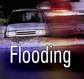
A nor’easter weather system continues to remain next to the southern New Jersey coastline and will continue to bring showers, rain, gusty winds, and minor coastal flooding to our region for the next 24 hours. It is still possible that during two high tide events on Friday that spotty to widespread minor coastal flooding may occur. Please be advised that any heavy rainfall during these high tide events may aggravate flooding conditions in flood-prone areas. Never attempt to drive your vehicle through any standing water on local streets. If you have any emergency, please call 911.
Rainy and windy weather will remain in our forecast for the next 48 hours. Please be advised that Ocean Drive heading north towards the Townsend’s Inlet Bridge will continue to be closed by local police due to wave overwash onto the roadway. Continue to monitor traditional local media forecasts for updated information, and be sure to view ShoreTV Channel 2 for updates as well. It is possible that the National Weather Service may extend the advisory into the beginning part of the weekend.
High tides: High tide is forecast at the Townsend’s Inlet Bridge between Avalon and Sea Isle City on Friday at 1:08am and 1:42pm. High tide is forecast at Stone Harbor/Great Channel on Friday at 1:35am and 2:09pm.
Here is the text of the Coastal Flood Advisory posted by the National Weather Service:
Coastal Flood Advisory in effect until 5 PM EDT Friday… … Coastal Flood Warning is cancelled…
The National Weather Service in Mount Holly has issued a coastal Flood Advisory… which is in effect until 5 PM EDT Friday. The coastal Flood Warning has been cancelled.
* Location… the New Jersey coast.
* Coastal flooding… widespread minor tidal flooding will continue through late this afternoon and is forecast with the Friday afternoon high tide. Any heavy rain that might occur near the time of high tide would contribute to the flooding.
* High surf with incoming easterly swells of 6 to 9 feet will probably result in beach erosion.
* Timing… high tide has passed for today. High tide along the Delaware and New Jersey coasts occurs between 200 PM and 230 PM Friday. High tide on the back bays occurs later than the high tide along the ocean front.
* Impacts… widespread roadway flooding will continue through late this afternoon and is forecast with the Friday afternoon high tide… with areas of heavy rain contributing to the problem.
* Outlook… minor tidal flooding might also occur on Saturday and Sunday.
* Seas… wave heights on the ocean waters will be 6 to 10 feet. Wave heights on the Delaware Bay will be 3 to 6 feet.
Precautionary/preparedness actions…
A coastal Flood Advisory indicates that minor tidal flooding is anticipated. Minor tidal flooding often results in some Road closures. Usually… the most vulnerable roadways will flood.
Do not leave your vehicle at a location that is prone to tidal flooding. Do not drive your vehicle through flood waters. The water may be deeper than you think it is. You will be putting yourself in danger and your vehicle may be damaged… leading to costly repairs.