
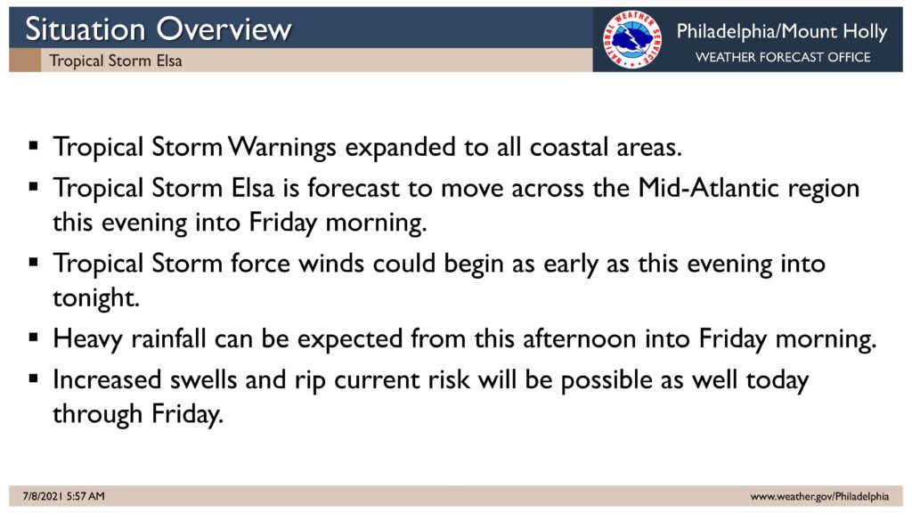
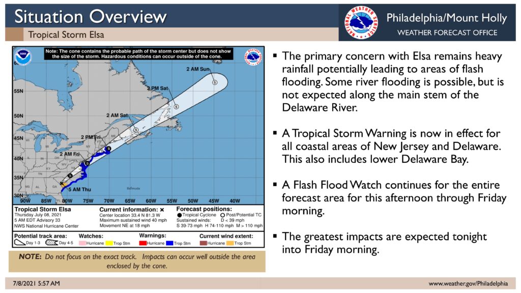
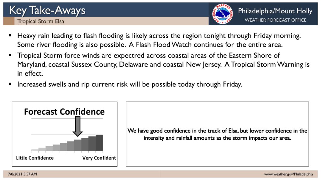
The National Weather Service has issued a Tropical Storm Warning for our region. A Flash Flood Watch remains in effect for our region from Thursday, July 8th at 5:00pm until Friday, July 9th at Noon.
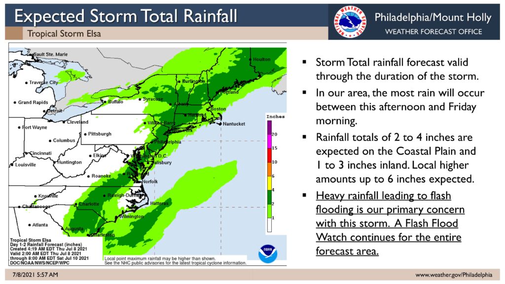
Tropical Storm Elsa is expected to move up the coastline today and will likely impact our region this evening into the overnight hours. The storm may bring gusty winds and brief periods of heavy rainfall. One to two inches of rain are expected along the coast, with higher amounts possible in localized areas. The storm is expected to be out of our area by Friday at Noon.
Now is the time to secure loose objects in your yard and decks. Consider moving objects inside including patio furniture, umbrellas, lawn chairs, and trash cans. If you experience rainfall flooding on a street, do not drive through it. Rainfall flooding is a temporary condition that will drain away. Rough surf and the potential for rip currents are expected. Obey all instructions provided by the beach patrol.
We continue to remain in contact with State and County offices of emergency management during this event. Continue to monitor updates provided on traditional media outlets.
Here is the complete text of the Warning provided on Thursday, July 8th, by the National Weather Service:
Tropical Storm Warning
Elsa Local Watch/Warning Statement/Advisory Number 33
National Weather Service Mount Holly NJ AL052021
507 AM EDT Thu Jul 8 2021
NJZ024-082115-
/O.CON.KPHI.TR.W.1005.000000T0000Z-000000T0000Z/
Atlantic Coastal Cape May-
507 AM EDT Thu Jul 8 2021
…TROPICAL STORM WARNING REMAINS IN EFFECT…
* LOCATIONS AFFECTED
– Cape May
– Wildwood
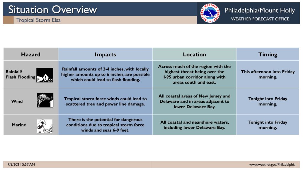
* WIND
– LATEST LOCAL FORECAST: Below tropical storm force wind
– Peak Wind Forecast: 15-25 mph with gusts to 45 mph
– THREAT TO LIFE AND PROPERTY THAT INCLUDES TYPICAL FORECAST
UNCERTAINTY IN TRACK, SIZE AND INTENSITY: Potential for wind 39
to 57 mph
– The wind threat has remained nearly steady from the
previous assessment.
– PLAN: Plan for hazardous wind of equivalent tropical storm
force.
– PREPARE: Efforts to protect property should now be
underway. Prepare for limited wind damage.
– ACT: Act now to complete preparations before the wind
becomes hazardous.
– POTENTIAL IMPACTS: Limited
– Damage to porches, awnings, carports, sheds, and unanchored
mobile homes. Unsecured lightweight objects blown about.
– Many large tree limbs broken off. A few trees snapped or
uprooted, but with greater numbers in places where trees
are shallow rooted. Some fences and roadway signs blown
over.
– A few roads impassable from debris, particularly within
urban or heavily wooded places. Hazardous driving
conditions on bridges and other elevated roadways.
– Scattered power and communications outages.
* STORM SURGE
– No storm surge inundation forecast
– THREAT TO LIFE AND PROPERTY THAT INCLUDES TYPICAL FORECAST
UNCERTAINTY IN TRACK, SIZE AND INTENSITY: Little to no storm
surge flooding
– The storm surge threat has remained nearly steady from the
previous assessment.
– PLAN: There is little to no threat of storm surge flooding.
Rough surf, coastal erosion, and life-threatening rip
currents are possible.
– PREPARE: Little to no preparations for storm surge flooding
are needed.
– ACT: Follow the instructions of local officials. Monitor
forecasts.
– REALIZED IMPACTS: Being Assessed
– Little to no additional surge impacts expected. Community
officials are now assessing the extent of actual surge
impacts accordingly.
* FLOODING RAIN
– LATEST LOCAL FORECAST: Flash Flood Watch is in effect
– Peak Rainfall Amounts: 1-3 inches, with locally higher
amounts
– THREAT TO LIFE AND PROPERTY THAT INCLUDES TYPICAL FORECAST
UNCERTAINTY IN TRACK, SIZE AND INTENSITY: Potential for
moderate flooding rain
– The flooding rain threat has remained nearly steady from
the previous assessment.
– PLAN: Emergency plans should include the potential for
moderate flooding from heavy rain. Evacuations and rescues
are possible.
– PREPARE: Consider protective actions if you are in an area
vulnerable to flooding.
– ACT: Heed any flood watches and warnings. Failure to take
action may result in serious injury or loss of life.
– POTENTIAL IMPACTS: Significant
– Moderate rainfall flooding may prompt several evacuations
and rescues.
– Rivers and tributaries may quickly become swollen with
swifter currents and overspill their banks in a few places,
especially in usually vulnerable spots. Small streams,
creeks, canals, arroyos, and ditches overflow.
– Flood waters can enter some structures or weaken
foundations. Several places may experience expanded areas
of rapid inundation at underpasses, low-lying spots, and
poor drainage areas. Some streets and parking lots take on
moving water as storm drains and retention ponds overflow.
Driving conditions become hazardous. Some road and bridge
closures.
* TORNADO
– LATEST LOCAL FORECAST:
– Situation is somewhat favorable for tornadoes
– THREAT TO LIFE AND PROPERTY THAT INCLUDES TYPICAL FORECAST
UNCERTAINTY IN TRACK, SIZE AND INTENSITY: Potential for a few
tornadoes
– The tornado threat has remained nearly steady from the
previous assessment.
– PLAN: Emergency plans should include the potential for a
few tornadoes.
– PREPARE: If your shelter is particularly vulnerable to
tornadoes, prepare to relocate to safe shelter before
hazardous weather arrives.
– ACT: If a tornado warning is issued, be ready to shelter
quickly.
– POTENTIAL IMPACTS: Limited
– The occurrence of isolated tornadoes can hinder the
execution of emergency plans during tropical events.
– A few places may experience tornado damage, along with
power and communications disruptions.
– Locations could realize roofs peeled off buildings,
chimneys toppled, mobile homes pushed off foundations or
overturned, large tree tops and branches snapped off,
shallow-rooted trees knocked over, moving vehicles blown
off roads, and small boats pulled from moorings.
