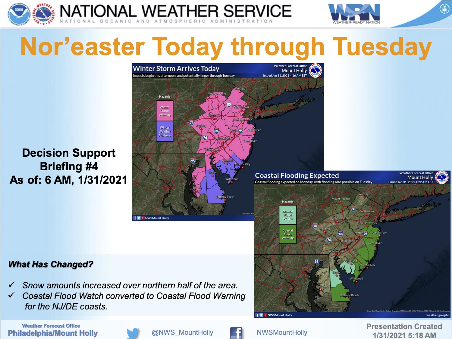
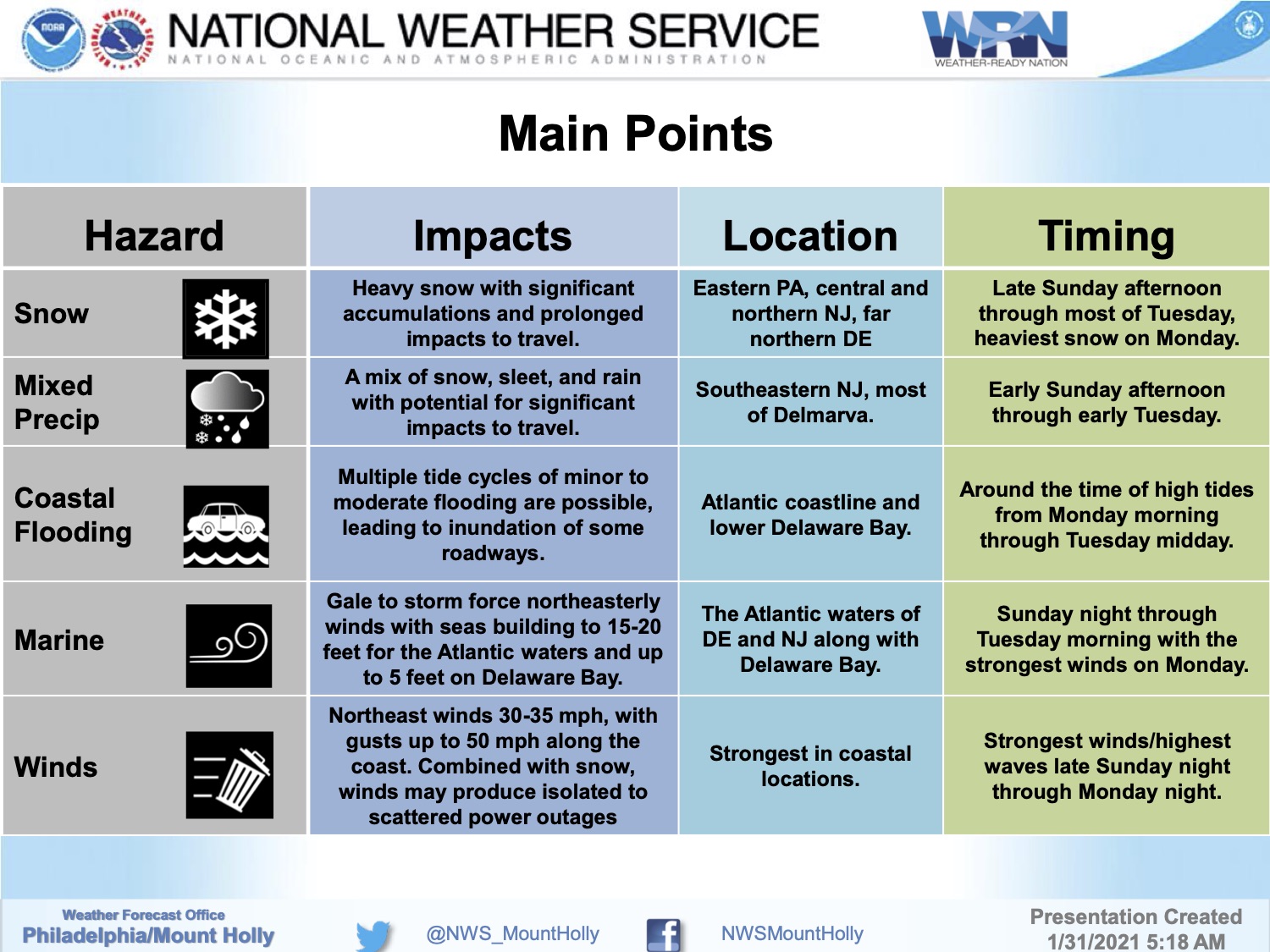
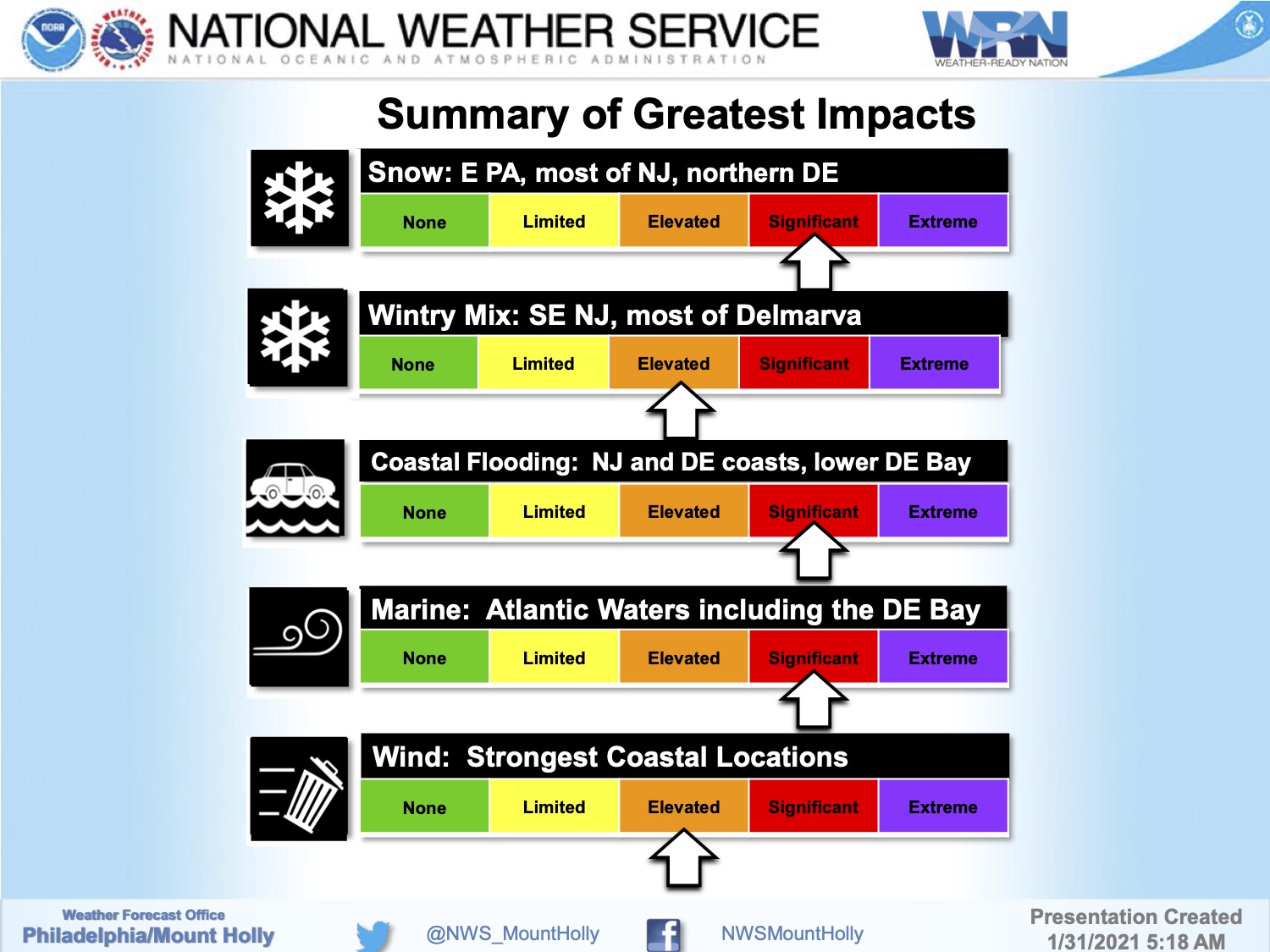
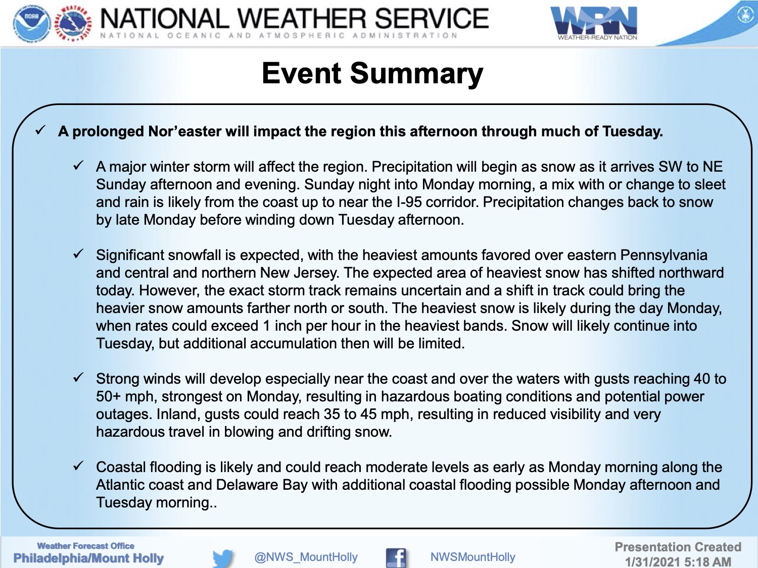
The National Weather Service has issued a Coastal Flood Warning and a Wind Advisory for Cape May County beach communities in advance of a nor’easter-type winter storm that will bring rain, snow, sleet, strong winds, and the potential for moderate coastal flooding.
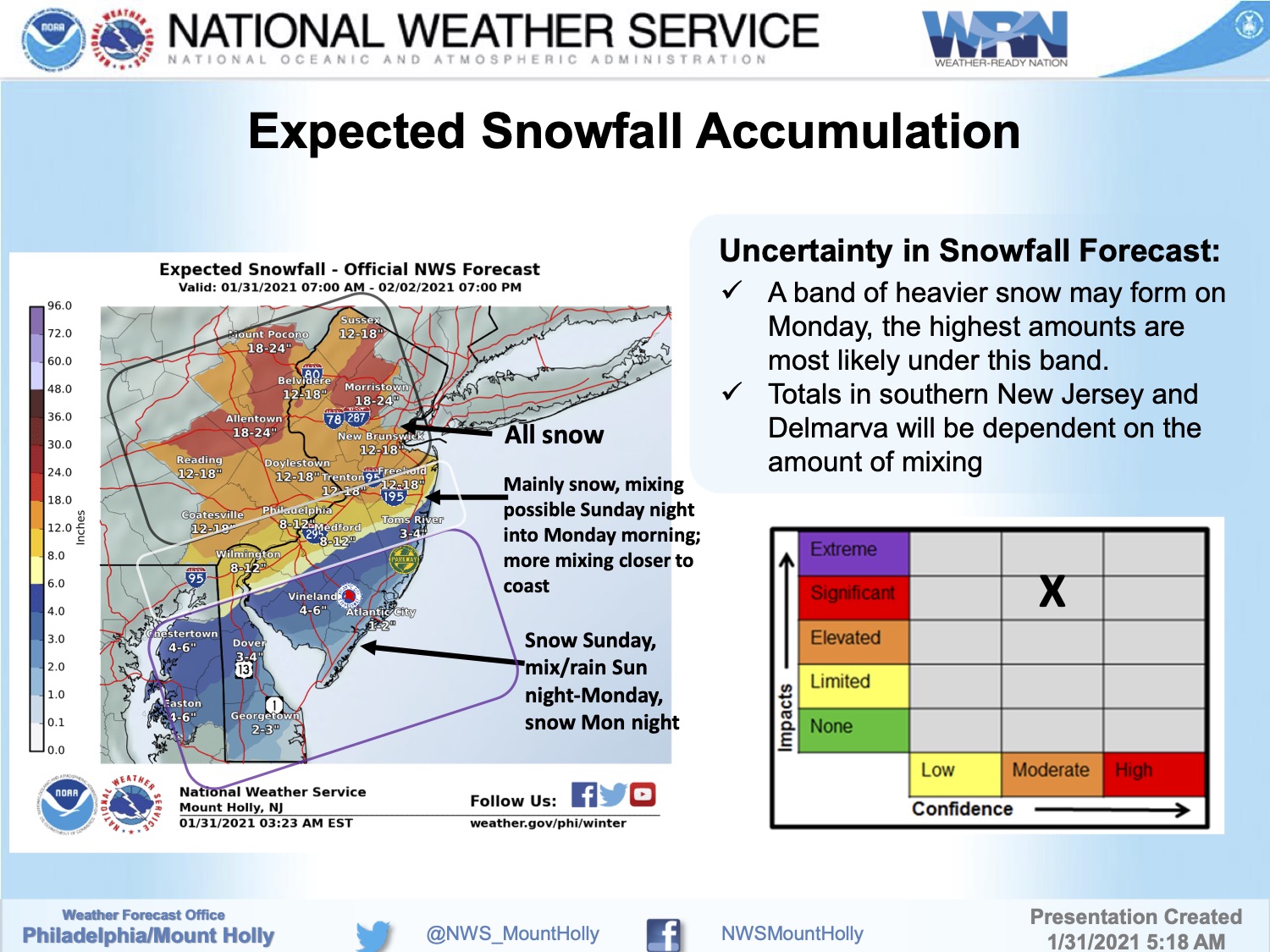
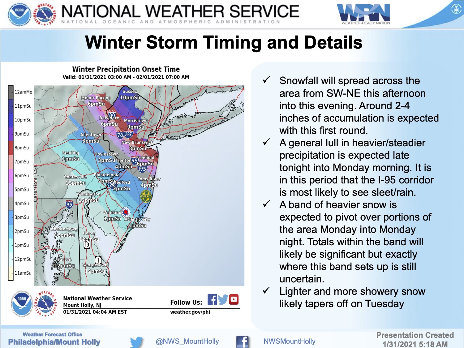
Snow is expected to develop during the mid afternoon hours on Sunday, followed by rain after sunset through Monday. The storm is expected to end with a rain and snow mix Monday evening. Please exercise caution while driving.
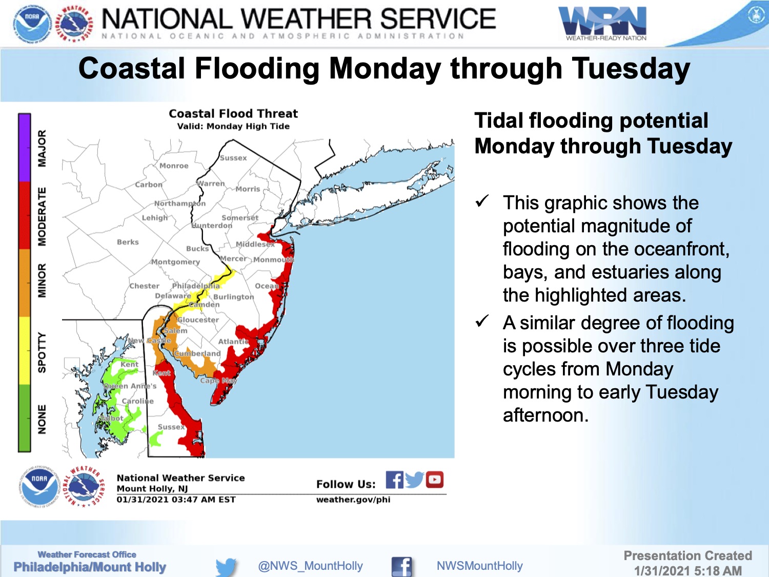
The Coastal Flood Warning is in effect for Monday morning through Tuesday afternoon. High tide occurs at the Townsend’s Inlet Bridge Monday at 10:17am, and again at 10:54pm; high tide occurs Tuesday morning at 11:05am. If you live on a street that typically receives tidal flooding, consider moving your vehicle to another portion of our community on Sunday. Never drive on a flooded street as this puts you and your vehicle at risk.
The Wind Advisory is in effect for Monday. Strong winds up to 40mph with gusts to 50mph are possible starting late morning through the evening hours. Secure any loose objects on your property. If you have any emergency, dial 911.
Continue to monitor this storm on traditional media outlets and on this communication channel. Updates will be provided as needed. Here is the graphics package on this nor’easter courtesy of the National Weather Service: