
The National Weather Service has continued the Coastal Flood Advisory for coastal Cape May County for Monday, January 23rd until 9:00pm. The High Wind Warning remains in effect for our region until Monday at 4:00pm.
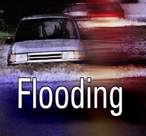
A coastal storm has descended upon our area with rain, heavy at times, strong gusty winds and the potential for coastal flooding. During this afternoon’s high tide event minor coastal flooding is expected with the potential for moderate coastal flooding in some coastal communities. High tide at the Townsend’s Inlet Bridge between Avalon and Sea Isle City is expected at 4:54pm. Please exercise caution while driving throughout the day; never drive on any flooded street or through any flooded intersection. If you have any emergency, dial 911.
The High Wind Warning means our region will be subject to easterly winds at 25-35mph throughout the day today with gusts to 60mph. This may result in intermittent power outages. If you have an outage, report it directly to Atlantic City Electric at 1-800-833-7476. Never attempt to move any power line or cable lying in the street. If you have outdoor objects that are subject to strong winds, consider moving them inside for the day.
Here is the text of the Coastal Flood Advisory and the High Wind Warning from the National Weather Service for Monday, January 23rd:
Coastal Flood Advisory
Issued: 4:13 AM EST Jan. 23, 2017 – National Weather Service
… Coastal Flood Advisory remains in effect until 9 PM EST this
evening…
* location… coastal areas of Cape May County in New Jersey and
Sussex County in Delaware… as well as areas along the Delaware
Bay.
* Coastal flooding… pockets of minor flooding will occur with the
upcoming high tide early this morning. Widespread minor flooding
is expected with the high tide late this afternoon into this
evening. There is a potential for localized moderate coastal
flooding late this afternoon into this evening.
* Timing… high tide on the New Jersey and Delaware oceanfront
occurs through 4:30 am this morning and again between 4:00 PM
and 5:00 PM this afternoon. High tide on the back bays and along
Delaware Bay occurs later than the high tide on the oceanfront.
* Surge… around 1.5 to 2 feet above the astronomical tide early
this morning. Around 3 to 3.5 feet above the astronomical tide
from late Monday afternoon into Monday evening.
* Waves… wave heights on the ocean waters off the coast are
forecast to build to 12 to 16 feet today. Waves on Delaware Bay
should increase to 3 to 7 feet.
* Impacts… localized roadway flooding will occur this morning.
Additional roadways are anticipated to flood from late this
afternoon into this evening. The late day flooding may be
compounded by rain. Also… the combination of very strong
onshore winds and battering waves will lead to significant beach
erosion.
* Outlook… lingering minor tidal flooding may occur again
around the high tide early on Tuesday morning.
Precautionary/preparedness actions…
A coastal Flood Advisory means that minor tidal flooding is
expected. Minor tidal flooding often results in some Road
closures. Usually… the most vulnerable roadways will flood.
Do not leave your vehicle at a location that is prone to tidal
flooding. Do not drive your vehicle through flood waters. The
water may be deeper than you think it is. You will be putting
yourself in danger and your vehicle may be damaged… leading to
costly repairs.
For a list of the impact of different tide heights in your County
please go to www.Weather.Gov/phi/tides
High Wind Warning
Issued: 3:11 AM EST Jan. 23, 2017 – National Weather Service
… High Wind Warning remains in effect until 4 PM EST this
afternoon…
* winds… east 25 to 35 mph with gusts up to 60 mph.
* Timing… the strongest winds are expected to occur after sunrise
this morning through mid afternoon.
* Wind impacts… damaging winds will blow down trees and power
lines. Scattered to numerous power outages are expected.
Travel will be difficult… especially for high profile
vehicles.
Precautionary/preparedness actions…
A High Wind Warning means a hazardous high wind event is expected
or occurring. Sustained wind speeds of at least 40 mph or gusts
of 58 mph or more can lead to property damage.
