POWERFUL STORM SYSTEM JANUARY 9-10, 2024
Coastal Hazard Message
National Weather Service Mount Holly NJ
909 AM EST Tue Jan 9 2024
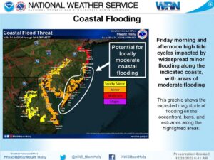
COASTAL FLOOD ADVISORY REMAINS IN EFFECT FROM 5 PM THIS
AFTERNOON TO 10 AM EST WEDNESDAY…
* WHAT…Up to one foot of inundation above ground level
expected in low-lying areas near shorelines and tidal
waterways.
* WHERE…Atlantic, Cape May, Atlantic Coastal Cape May and
Coastal Atlantic.
* WHEN…From 5 PM this afternoon to 10 AM EST Wednesday.
* IMPACTS…At this level, flooding begins on the most
vulnerable roads in coastal and bayside communities, and along
inland tidal waterways. Some partial or full road closures are
possible.
* ADDITIONAL DETAILS…The highest water levels are expected in
the back bays.
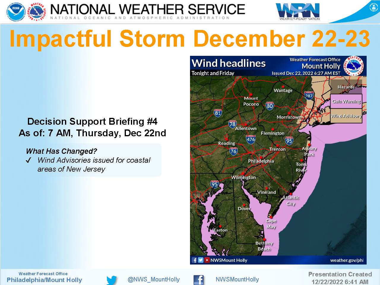
HIGH WIND WARNING REMAINS IN EFFECT FROM 6 PM THIS EVENING TO
4 AM EST WEDNESDAY…
* WHAT…Southeast to south winds 35 to 45 mph with gusts up to
65 mph expected.
* WHERE…Portions of southern Delaware and central and southern
New Jersey.
* WHEN…From 6 PM this evening to 4 AM EST Wednesday.
* IMPACTS…Damaging winds will blow down trees and power lines.
Widespread power outages are expected. Travel will be
difficult, especially for high profile vehicles.
* ADDITIONAL DETAILS…Southeast winds will increase during today
and become stronger later this afternoon. The damaging winds
are expected to occur this evening, and these could be locally
enhanced with a narrow line of intense showers later tonight.
For current up-to-date information refer to Stone Harbor’s Facebook page or the Stone Harbor OEM Facebook page.
In case of an emergency call 911.