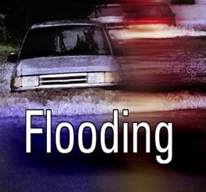
Sunday, May 27th, 11:04am: Flash Flood Watch Issued By National Weather Service

The National Weather Service has issued a Flash Flood Watch for the Borough and the entire Jersey Shore region. The Watch is in effect from Sunday, at 10:00am until Monday, at 4:00am.
Showers and thunderstorms are expected to develop Sunday afternoon and into the evening hours on Sunday. Any storms may produce a good deal of rainfall in a short period of time which could lead to street flooding. If you hear thunder or see lightning, seek shelter immediately. Never attempt to drive your vehicle on any flooded street or intersection as this puts you and your vehicle at risk. Continue to monitor traditional media outlets for updates on our forecast.
Here is the text of the Flash Flood Watch issued by the National Weather Service:
Flash Flood Watch
Flood Watch National Weather Service Mount Holly NJ 958 AM EDT Sun May 27 2018 ...FLASH FLOOD WATCH IN EFFECT THROUGH LATE TONIGHT... The National Weather Service in Mount Holly has expanded the * Flash Flood Watch to include portions of Delaware, northeast Maryland, and southern New Jersey, including the following areas, in Delaware, Delaware Beaches, Inland Sussex, Kent, and New Castle. In northeast Maryland, Caroline, Cecil, Kent MD, Queen Annes, and Talbot. In southern New Jersey, Atlantic Coastal Cape May, Cape May, Cumberland, and Salem. * Until 4 AM EDT Monday morning * Additional showers and thunderstorms are expected to develop early this afternoon across southeastern Pennsylvania and the eastern shore of Maryland and move slowly eastward across southern New Jersey and Delaware through tonight. Torrential downpours may lead to excessive rainfall amounts of up to two inches in one hour and two to five inches within a few hours. Excessive rainfall within a short period of time can lead to rapidly rising waters, particularly in urban areas and along small streams, which can lead to flash flooding. PRECAUTIONARY/PREPAREDNESS ACTIONS... A Flash Flood Watch means that there is the potential for flash flooding which can be life-threatening. Heavy rain is expected to occur over a short period of time. Rapidly rising flood waters may quickly inundate roadways and areas of poor drainage. Streams and creeks could leave their banks, flooding nearby properties. Please monitor the forecast, especially if you live in a location that is prone to flooding. Be prepared to take action if a flash flood warning is issued for your area.