Tuesday, January 28th–Winter Storm Warning In Effect, 3-5 Inches of Snow Possible
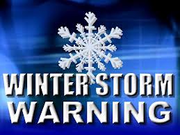 The National Weather Service has issued a Winter Storm Warning for the Borough and coastal Cape May County for a winter storm that is forecasted for our area. There is a chance of a snowfall of three to five inches as a result of the storm. A winter storm will bring heavier snow, sleet, ice, and freezing rain to the south. The storm is expected to brush by the Jersey Shore and bring snowfall to our region. The Winter Storm Warning is in effect from Tuesday, January 28th through Wednesday, January 29th, at 6:00am. Snow is expected to develop over our region this evening. It will remain cold enough for an all snow event.
Please exercise caution while driving this evening and during the early morning hours on Wednesday. If you have any emergency, please dial 9–1-1.
Here is the text of the Winter Storm Warning issued by the National Weather Service for our community:
Winter Storm Warning in effect until 6 am EST Wednesday…
The National Weather Service in Mount Holly has issued a Winter Storm Warning for heavy snow… which is in effect until 6 am EST Wednesday. The Winter Weather Advisory is no longer in effect.
* Locations… Sussex County Delaware and Cape May County New Jersey.
* Snow accumulations… 3 to 5 inches.
* Timing… snow will overspread Delaware late this afternoon and reach into New Jersey early this evening. The heaviest snow is expected to occur between 9 PM and 3 am tonight. The snow should end by the start of the morning commute on Wednesday.
* Impacts… roads will become snow covered and slippery due to temperatures well below freezing and accumulating snow. Travel conditions will become hazardous. Snow covered roadways will considerably slow the Wednesday morning commute.
* Winds… north 10 to 15 mph with gusts up to 25 mph.
* Temperatures… mainly 10 to 15 degrees while it is snowing.
Precautionary/preparedness actions…
A Winter Storm Warning means significant amounts of snow are expected. This will make travel very hazardous or impossible. Please make sure you have blankets in your vehicle and a charged cell phone if traveling overnight. Better yet, please avoid any unnecessary traveling. Give yourself extra time to reach your destination Wednesday morning.