
Friday, May 18th: Coastal Flood Advisory, Flood Watch Remain for Stone Harbor
The National Weather Service has continued the Flood Watch and has now issued a Coastal Flood Advisory for the Borough. The Flood Watch is in effect from now through Saturday afternoon, and the Coastal Flood Advisory is in effect from Friday, May 18th at 9:00pm through Saturday, May 19th at 2:00am.
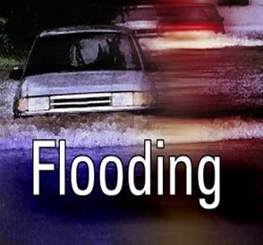
A low pressure system will continue to produce rain in our region through Saturday morning. The rain could be heavy at times which could cause some street flooding. Never drive on a flooded street as this puts you, and your vehicle, in danger. The Coastal Flood Advisory means minor tidal flooding could occur at time of high tide late Friday evening; high tide at the Townsend’s Inlet Bridge will occur at 11:21pm Friday.
Streets that typically flood during coastal flood events may see some water. Continue to exercise caution while driving.
Here is the text of the Flood Watch and the Coastal Flood Advisory issued by the National Weather Service:
Coastal Flood Advisory
Coastal Hazard Message National Weather Service Mount Holly NJ 404 AM EDT Fri May 18 2018 ...COASTAL FLOOD ADVISORY IN EFFECT FROM 9 PM THIS EVENING TO 2 AM EDT SATURDAY... The National Weather Service in Mount Holly has issued a Coastal Flood Advisory, which is in effect from 9 PM this evening to 2 AM EDT Saturday. * LOCATIONS...The Atlantic coastal waters of New Jersey and Delaware and the adjacent areas near lower Delaware Bay. * COASTAL FLOODING...Minor tidal flooding expected. * TIMING...The high tide between roughly 11 p.m. and 1 a.m. High tide will occur several hours later across the back bays. PRECAUTIONARY/PREPAREDNESS ACTIONS... A Coastal Flood Advisory means that minor tidal flooding is expected. Minor Tidal flooding often results in some road closures. Usually...the most vulnerable roadways will flood. Do not leave your vehicle at a location that is prone to tidal flooding. Do not drive your vehicle through flood waters. The water may be deeper than you think it is. You will be putting yourself in danger and your vehicle may be damaged...leading to costly repairs. Visit the Advanced Hydrologic Prediction Service at water.weather.gov/ahps for additional water level and flood impact information for your local tide gauge. Flood Watch
Flood Watch National Weather Service Mount Holly NJ 342 AM EDT Fri May 18 2018 ...FLOOD WATCH REMAINS IN EFFECT THROUGH SATURDAY AFTERNOON... The Flood Watch continues for * Delaware, northeast Maryland, most of New Jersey, and portions of southeast Pennsylvania. * Through Saturday afternoon * Periods of moderate to heavy rain will move into southern New Jersey and the Delmarva this morning. Periods of moderate to heavy rain will move into Delmarva late tonight through Saturday morning, then expand northward into southeastern Pennsylvania and New Jersey Saturday afternoon and night. Additional rainfall amounts of 1 to 4 inches are expected over the next 72 hours with the highest totals occurring in Delmarva and far southern New Jersey. Locally higher amounts over 5 inches are possible in slow-moving thunderstorms. * A variety of flooding types are possible. Low-lying and poor drainage flooding will be the most common type of flooding to develop. Flash flooding will also be possible if thunderstorms repeatedly move over the same locations, especially in urban areas where rainfall runoff is maximized and where small creeks and streams respond quickly. Flash flooding occurs quicker than other types flooding due to the torrential rain thunderstorms can produce in a short amount of time. Several days of excessive runoff will eventually lead to a risk of flooding in larger streams and rivers though the extent of the flooding will depend on where the heaviest rain falls. PRECAUTIONARY/PREPAREDNESS ACTIONS... A Flood Watch means there is a potential for flooding based on current forecasts.
