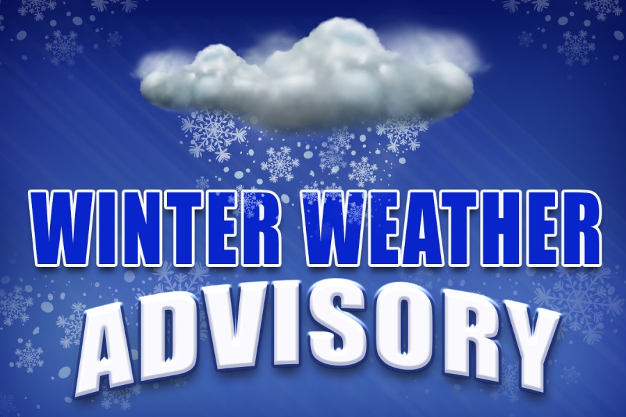
Sun, Jan. 29th, 7:31am: Winter Weather Advisory Monday, 1-3″ Snow Possible

The National Weather Service has issued a Winter Weather Advisory for Cape May County for Monday, January 30th from 3:00am until Noon. There is the potential for one to three inches of snow from this storm with a changeover likely at some point to rain, especially along the barrier islands.
A small storm system will move through Tennessee and the western portion of North Carolina before coming up to the Mid Atlantic states during the overnight hours Sunday night into Monday morning. Slippery driving conditions are possible with the morning commute. Exercise caution while driving. The current forecast does not call for a major snow event.
Here is the current Winter Weather Advisory posted Sunday morning by the National Weather Service:
Winter Weather Advisory
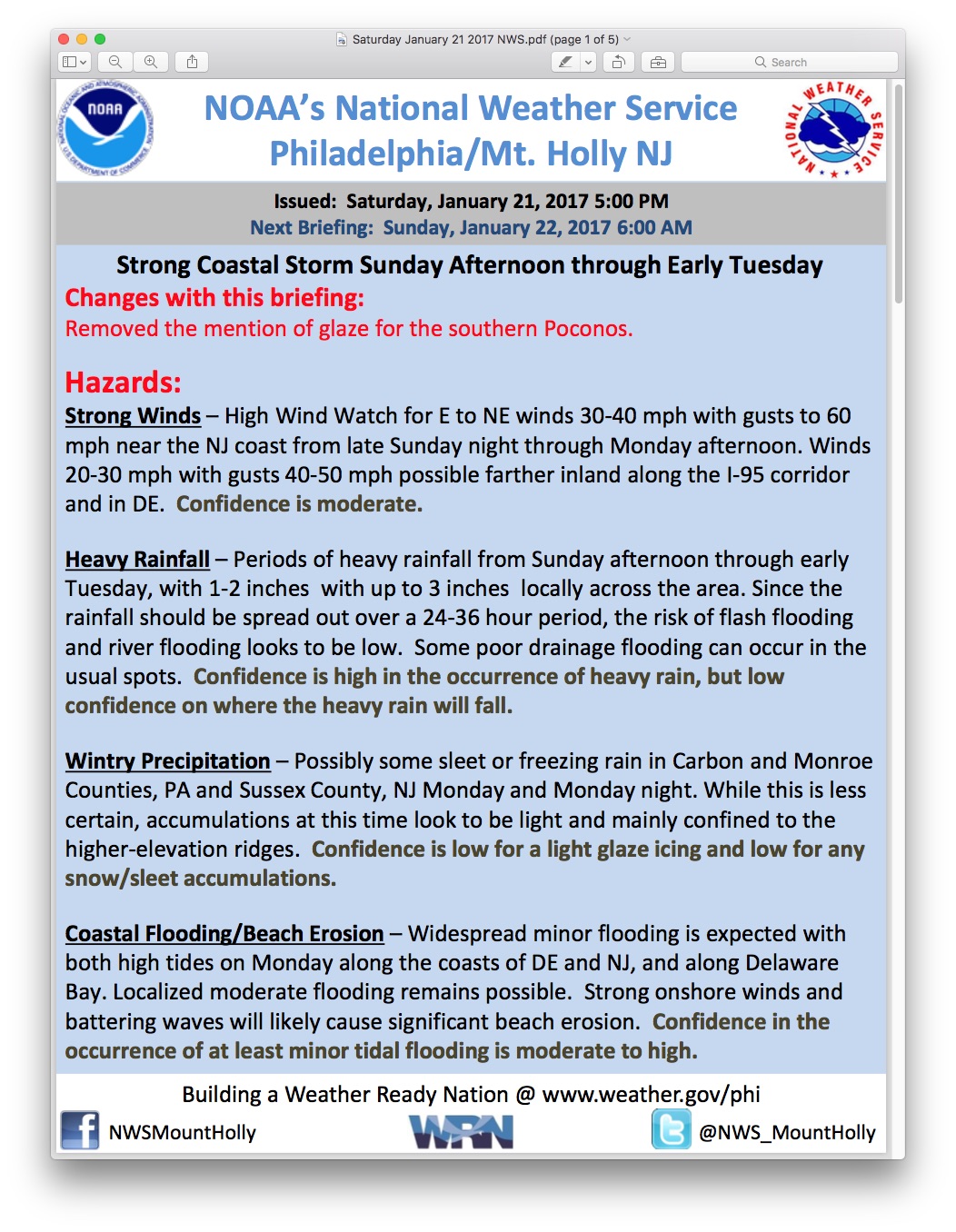
URGENT – WINTER WEATHER MESSAGE
NATIONAL WEATHER SERVICE MOUNT HOLLY NJ
324 AM EST SUN JAN 29 2017
…SNOW IS EXPECTED FOR LATE TONIGHT INTO MONDAY MORNING…
.LOW PRESSURE IS FORECAST TO DEVELOP OVER VIRGINIA LATE TODAY.
THE LOW IS ANTICIPATED TO PASS OFF THE DELMARVA COAST LATE TONIGHT
BEFORE MOVING OUT TO SEA ON MONDAY.
NJZ016>018-020>027-292100-
/O.NEW.KPHI.WW.Y.0006.170130T0800Z-170130T1700Z/
SALEM-GLOUCESTER-CAMDEN-OCEAN-CUMBERLAND-ATLANTIC-CAPE MAY-
ATLANTIC COASTAL CAPE MAY-COASTAL ATLANTIC-COASTAL OCEAN-
SOUTHEASTERN BURLINGTON-
INCLUDING THE CITIES OF PENNSVILLE, GLASSBORO, CAMDEN,
CHERRY HILL, JACKSON, MILLVILLE, HAMMONTON, CAPE MAY COURT HOUSE,
OCEAN CITY, ATLANTIC CITY, LONG BEACH ISLAND,
AND WHARTON STATE FOREST
324 AM EST SUN JAN 29 2017
…WINTER WEATHER ADVISORY IN EFFECT FROM 3 AM TO NOON EST
MONDAY…
THE NATIONAL WEATHER SERVICE IN MOUNT HOLLY HAS ISSUED A WINTER
WEATHER ADVISORY FOR SNOW. IT IS IN EFFECT FROM 300 AM MONDAY
UNTIL NOON ON MONDAY.
* LOCATIONS…SOUTHERN NEW JERSEY.
* HAZARD TYPE…SNOW.
* SNOW ACCUMULATIONS…FROM 1 TO 3 INCHES.
* TIMING…SNOW IS FORECAST TO OVERSPREAD THE REGION AFTER
MIDNIGHT AND IT SHOULD CONTINUE INTO MONDAY MORNING. THE SNOW
MAY MIX WITH OR CHANGE TO RAIN BEFORE ENDING BY MIDDAY ON
MONDAY.
* IMPACTS…THE SNOW MAY IMPACT TRAVEL CONDITIONS, ESPECIALLY DURING
THE MONDAY MORNING COMMUTE. ROADS AND WALKWAYS MAY BECOME SNOW
COVERED AND SLIPPERY.
* TEMPERATURES…GENERALLY IN THE UPPER 20S AND LOWER 30S DURING
THE SNOW EVENT.
* VISIBILITY…AROUND OR LESS THAN A HALF MILE AT TIMES.
PRECAUTIONARY/PREPAREDNESS ACTIONS…
THIS WINTER WEATHER ADVISORY MEANS THAT A PERIOD OF SNOW MAY
CAUSE TRAVEL DIFFICULTIES. BE PREPARED FOR SLIPPERY ROADS AND
LIMITED VISIBILITY. USE EXTRA CAUTION WHILE DRIVING.