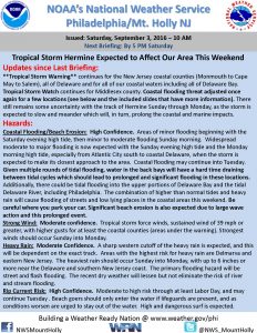
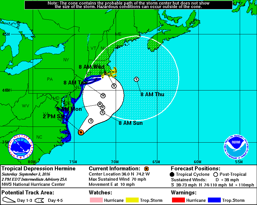
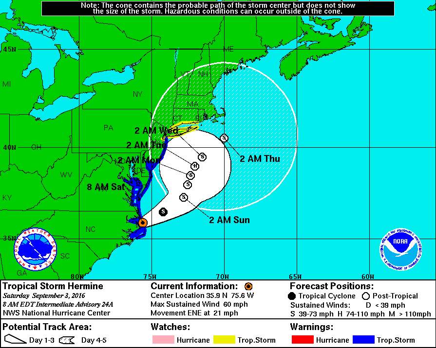
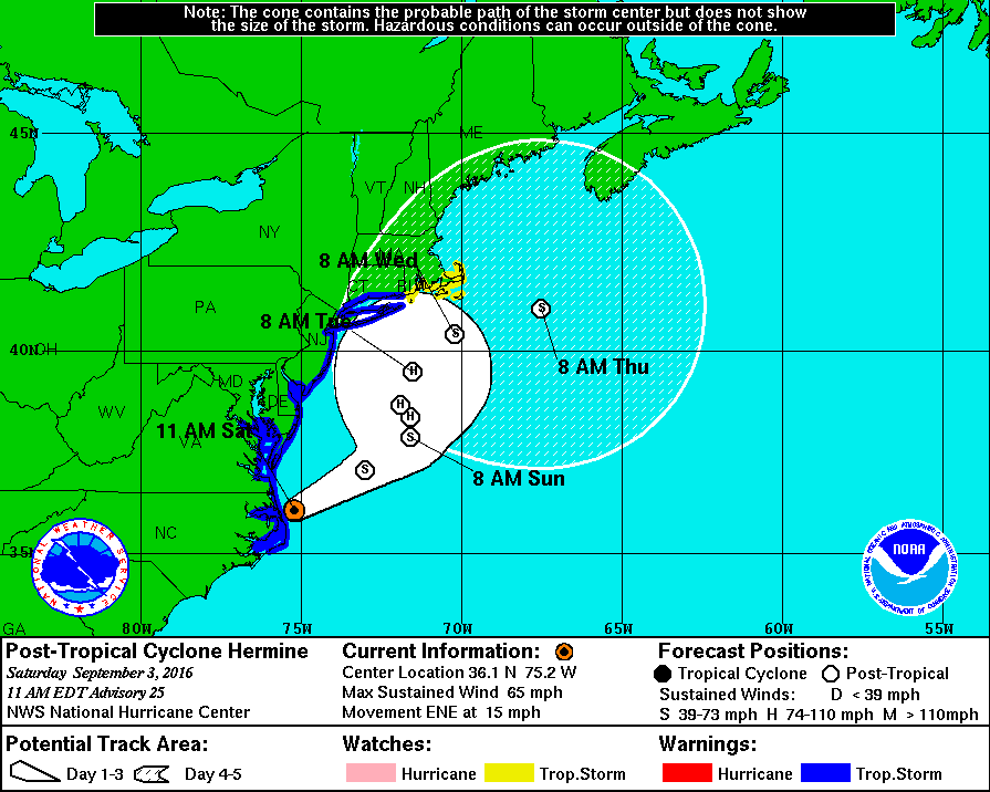
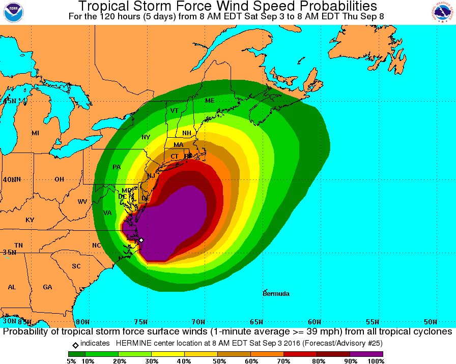
Sat, Sept. 3rd, 5:50pm: Tropical Storm Warning Continues, Flooding Still Major Concern
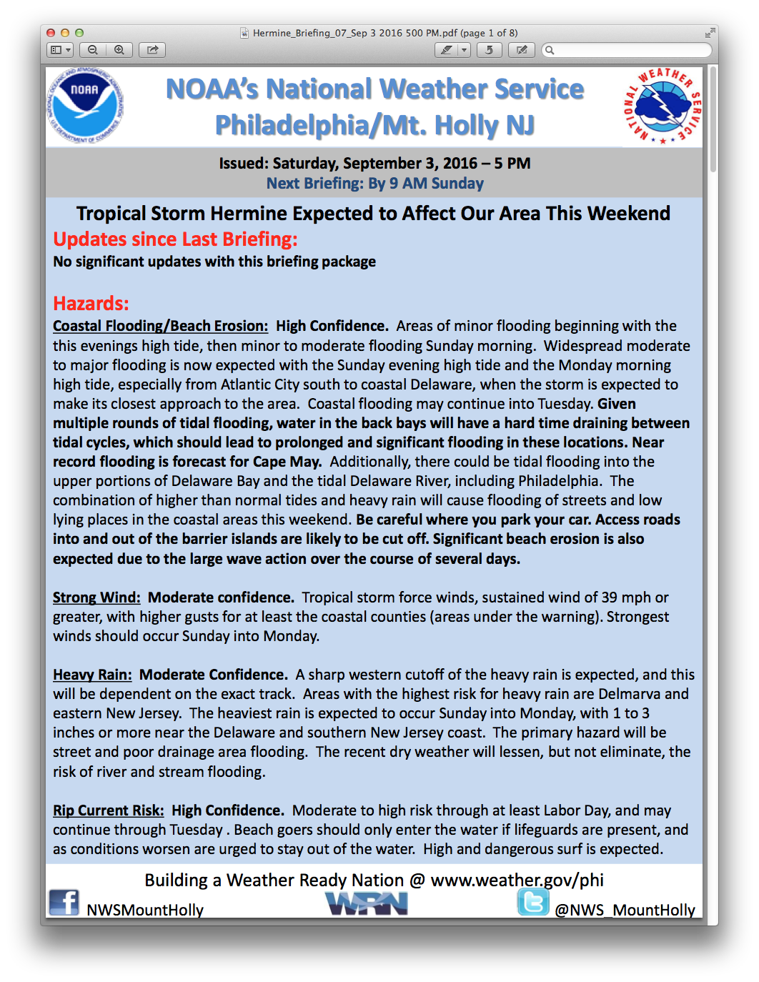
The National Weather Service has continued the Tropical Storm Warning for the Borough of Stone Harbor during its latest briefing on Saturday, September 3rd, at 5:00pm. The Service has continued to forecast the potential for strong gusty winds, occasional rain, beach erosion, rough surf, strong rip currents, and moderate/potential major coastal flooding. This Tropical Storm Warning continues for the Labor Day weekend holiday.
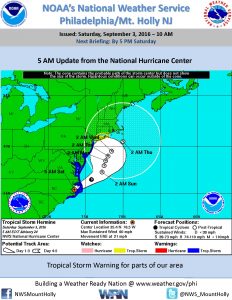
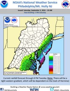
The latest computer models put the storm just offshore of the State of New Jersey with heavy rains and strong winds in the Atlantic Ocean. The forecast continues to show the storm moving away from the East Coast of the United States before taking a slight turn west towards the coastline Sunday night through Tuesday. The current forecast then calls for the storm to continue moving along the coastline to New England by Wednesday into Thursday. Tropical Storm Warnings remain for the entire coast of New Jersey. The weather risks to the Borough include wind gusts Saturday night into Sunday morning approaching 55mph, with additional rainfall expected Sunday through Labor Day Monday.
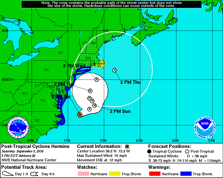
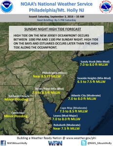
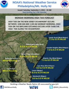
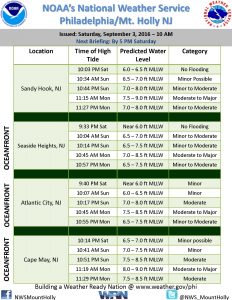
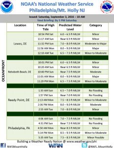
There remains a significant threat of coastal flooding to the Borough during times of high tide. The tides of greatest concern remain the high tide events on Sunday evening and again on Monday morning. Visitors to Stone Harbor who plan to relocate to the mainland should consider doing so in between any high tide event when the flood risk is less.
High tide in Stone Harbor occurs at 10:48pm on Saturday; high tide on Sunday occurs at 11:14am and again at 11:25pm, and high tide on Monday will be at 11;53am. Moderate to possibly major coastal flooding is expected at times of high tide on Sunday evening and Monday morning.

In advance of any flood advisory, watch, or warning, consider moving your vehicle to higher ground. Never park your vehicle on a bridge or traffic island as these are needed for emergency vehicles, including fire trucks. Never attempt to drive your vehicle on any flooded street or through a flooded intersection as this puts you in danger and also creates an unnecessary wake that can damage private property and other vehicles. It is best that you shelter at your property during times of high tide; rising tidal flooding typically subsides within a couple of hours of a high tide along the back bay. If you have an emergency during the storm, please dial 911.
Bathers are not permitted to enter the ocean in Stone Harbor until further notice. Boaters are asked to check on their boats, secure them, and if possible, remove them from slips. Secure all property prone to wind including trash cans, umbrellas, patio furniture, and the like. You can expect intermittent closures of the Townsend’s Inlet Bridge between Avalon and Sea Isle City near times of high tide due to wave over wash on the road leading to the bridge.
Never attempt to move any downed utility wire. If you have a power outage, please report the outage to Atlantic City Electric at 1-800-833-7476. Be sure to have your street address available to report the outage.
Secure any loose outdoor objects including trash cans/lids, umbrellas, patio furniture, and flags.
Residents, property owners, and visitors are encouraged to constantly check www.stoneharboremergency.com for the latest updates, advisories, directions, and information regarding this storm. Updates are also available on Avalon’s AM radio station, 1630AM.