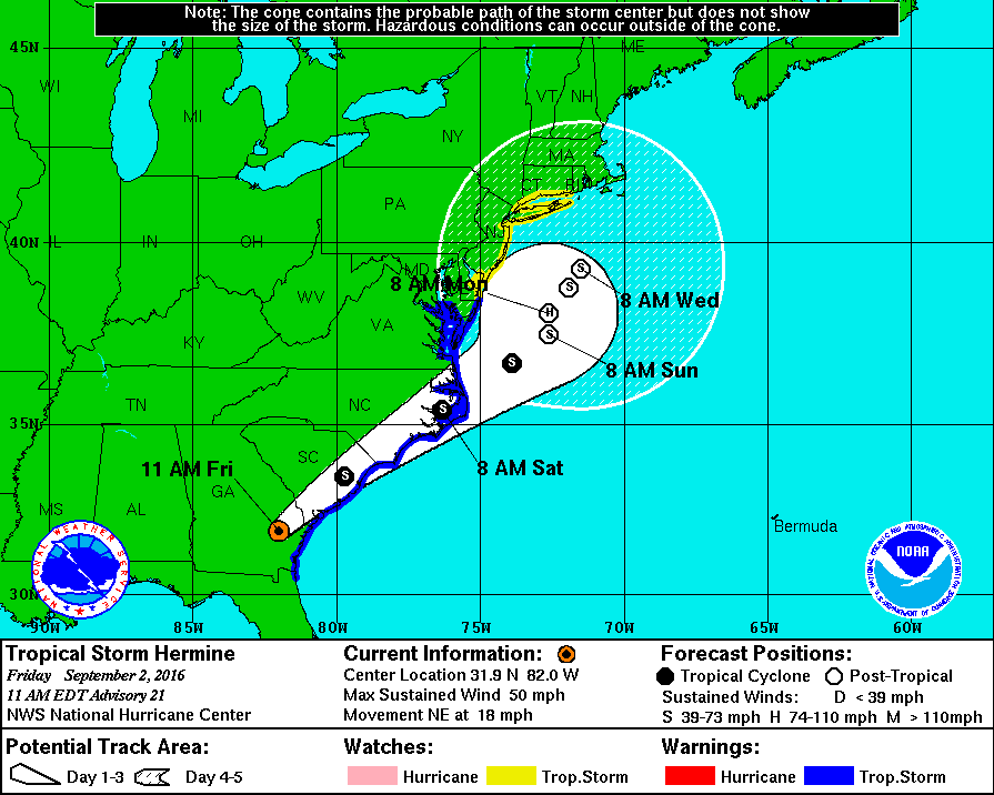
Fri, Sept. 2nd, 5:22pm: Tropical Storm Warning For Stone Harbor, Rain/Wind/Flooding Expected
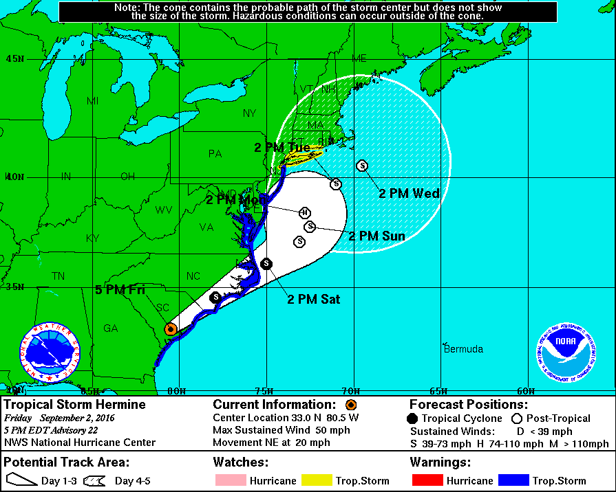
The National Weather Service has posted a Tropical Storm Warning for the Borough of Stone Harbor through Labor Day weekend. The Service provided its latest advisory to emergency management partners on Friday, September 2nd, at 5:00pm. The effects of Tropical Storm Hermine will be felt in our region starting on Saturday and lasting through possibly Monday. The effects may include strong wind, rain, the potential for moderate coastal flooding, rough surf, beach erosion, and strong rip currents along the New Jersey coastline. Rain is expected to develop Saturday morning, and increase in intensity Saturday afternoon through Sunday. Stronger winds are possible Sunday into Sunday evening.
Computer models agree that the storm will move along the southeast coast and likely venture towards the east near the coastline of New Jersey. There is a potential for the storm to stall in the Atlantic Ocean and strengthen to a Category One hurricane which could prolong effects along our beaches, especially regarding rough surf and dangerous rip currents.
The Borough may experience minor to moderate coastal flooding at time of high tide especially Saturday evening and during the two high tide events on Sunday. High tide at the Townsend’s Inlet Bridge on Saturday, September 3rd will occur at 10:36am and again at 10:48pm; high tide will occur on Sunday, September 4th at 11:14am and again at 11:25pm. High tide will occur on Monday at 11:53am, and again Tuesday at 12:03am.
In advance of any flood advisory, watch, or warning, consider moving your vehicle to higher ground. Never park your vehicle on a bridge or traffic island. Street flooding may also occur during periods of heavy rainfall. Never attempt to drive your vehicle on any flooded street or through a flooded intersection as this puts you in danger and also creates an unnecessary wake that can damage private property and other vehicles. If you have an emergency during the storm, please dial 911.
Please obey all instructions provided by the Stone Harbor Beach Patrol. Do not enter the ocean unless you are in the presence of an on-duty lifeguard. Do not enter the ocean before or after guards are on duty. Be aware that rip currents may take swimmers away from the water’s edge very quickly.
Never attempt to move any downed utility wire. If you have a power outage, please report the outage to Atlantic City Electric at 1-800-833-7476. Be sure to have your street address available to report the outage.
During periods of windy weather conditions be sure to secure any loose outdoor objects including trash cans/lids, umbrellas, patio furniture, and flags. Contractors have been told to secure their active job sites in advance of strong winds.
Avalon will continue to provide alerts on our weather conditions at www.stoneharboremergency.com, Channel 97 for Comcast cable customers and when necessary, our Code Red emergency telephone call system.