
Wed, Jan. 20th, 5:40pm: Coastal Flood Watch Posted, Winter Weather On Its Way
The National Weather Service has issued both a Coastal Flood Watch for the Borough of Stone Harbor and other coastal communities in advance of a winter storm that will impact our region especially on Friday and Saturday. There is the potential for snow, rain, strong winds, and at least moderate coastal flooding from this storm event. This has been a difficult forecast for the National Weather Service and we expect further updates with more specific information over the next 48 hours as the storm approaches the Mid-Atlantic region.
There is the potential for some light snow this evening over our community during the overnight hours into early Thursday morning. This is not associated with the larger winter storm that will impact our area on Friday and Saturday, January 22nd-23rd. Snow possibly mixing with rain is expected over our region late Friday afternoon with the precipitation becoming all rain during the overnight hours Friday into Saturday. Winds will be gusty during the overnight hours and approach 50mph. Saturday’s forecast brings plenty of rain to our community along with very windy conditions, with gusts approaching 60mph. The storm is expected to end as a mix of rain and snow before Midnight Saturday. Some light snow and rain is possible on Sunday morning before the storm moves away from our region.
Areas towards Philadelphia will be experiencing a significant snowfall event. The Wednesday evening forecast does not call for significant snowfall for our immediate area; our biggest concerns remain coastal flooding, strong winds, rough surf/beach erosion, and the potential for power outages. Please remember: This forecast has the potential to change over the next 48 hours; we invite you to follow www.stoneharboremergency.com for updated information during this storm event.
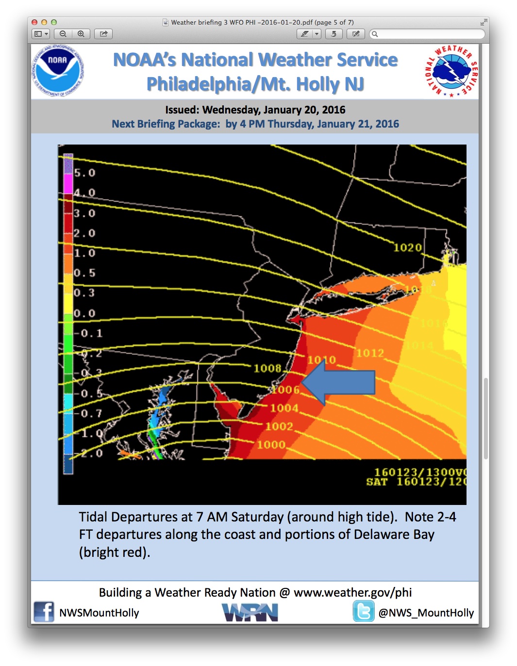
The Coastal Flood Watch for our region calls for widespread moderate coastal flooding throughout the Jersey Shore, with the potential for major coastal flooding in some areas. The National Weather Service believes this flooding event will likely cover three high tides, two on Saturday and the morning high tide event on Sunday. Wave heights on the ocean could build to 20 feet on Saturday on the ocean front. Streets that typically flood during coastal flood events are expected to experience high water during these high tides.
High tide at the Townsend’s Inlet Bridge between Avalon and Sea Isle City will occur Saturday at 7:17am, and again at 743pm. High tide on Sunday occurs at 8:00am, and again at 8:27pm. Please note the bridge is closed for the next few weeks as final repairs are being made on the bridge and on the roadway approaching the bridge.
If you live on a street that typically floods during coastal flooding events, please consider moving your vehicles to higher ground especially during the Saturday high tide events. Please plan to secure outdoor objects that are prone to high winds, including deck furniture and trash cans. Never attempt to drive through any high water on a street or intersection. If you have any emergency, dial 911. The Stone Harbor Department of Emergency Management is in constant communication with the Cape May County Office of Emergency Management and our weather partners to bring you the latest information.
Power outages are possible during this winter storm. You can view the Atlantic City Electric power outage map and you can report a power outage as well on opens in a new windowwww.atlanticcityelectric.com.
Here is the advisory provided to emergency management partners throughout the Philadelphia region by the National Weather Service: National Weather Service Storm Discussion Wednesday evening January 20th
