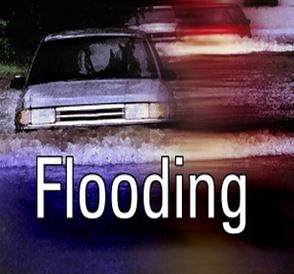
FRIDAY, OCT. 11TH UPDATE: COASTAL FLOOD ADVISORY EXTENDED, HEAVY RAIN FRIDAY MORNING
 The National Weather Service has extended a Coastal Flood Advisory for our region until Saturday, October 12th, at 6:00pm. A persistent northeast coastal storm continues to bring strong winds, heavy rain, and some minor coastal flooding at time of high tide to our community. Any high tide event today and tomorrow may be aggravated by heavy rains that may fall in the region. Continue to monitor this weather system on traditional media outlets. Never attempt to drive through standing water, and if you have any emergency, please dial 911. Avalon Police continue to close Ocean Drive towards the Townsend’s Inlet Bridge due to wave overwash on the roadway. If you have any outdoor objects that are prone to high winds, bring them inside. Avoid driving in flood prone areas during time of high tide.
Here is the tide information for Friday and Saturday. At the Townsend’s Inlet Bridge, high tide will occur Friday at 1:42pm, and again on Saturday at 2:22am and 2:53am. At Stone Harbor/Great Channel, high tide will occur on Friday at 2:09pm, and again on Saturday at 2:49am and 3:20pm.
Here is the text of the Coastal Flood Advisory from the National Weather Service, along with an advisory about heavy rain along the Jersey Shore:
Coastal Flood Advisory now in effect until 6 PM EDT Saturday…
* coastal flooding… widespread minor coastal flooding is expected during the Friday afternoon high tide cycle. Any heavy rain that might occur near the time of high tide would enhance the flooding. The prolonged onshore winds may also keep the back bays from draining… allowing the minor flooding to persist longer. Another round of minor tidal flooding is expected during the Saturday afternoon high tide cycle, with the possible exception of northern coastal New Jersey where water levels may peak just below the minor flood mark.
* High surf with incoming easterly swells of 6 to 9 feet will result in areas of beach erosion.
* Timing… high tide along the New Jersey and Delaware ocean fronts occurs between 100 PM and 300 PM both Friday and Saturday. High tide on the back bays occurs later than the high tide along the ocean front. High tide on Saturday occurs
* impacts… widespread poor drainage and roadway flooding is forecast with the Friday afternoon and Saturday afternoon high tide.
* Outlook… given the prolonged onshore flow… minor coastal flooding is possible again on Sunday afternoon.
* Seas… 6 to 10 feet on the ocean waters, and 2 to 6 feet on Delaware Bay.
Precautionary/preparedness actions…
A coastal Flood Advisory indicates that minor tidal flooding is anticipated. Minor tidal flooding often results in some Road closures. Usually… the most vulnerable roadways will flood.
Statement as of 5:08 AM EDT on October 11, 2013
… Showers and isolated thunderstorms with heavy rain will continue to affect the Delmarva Peninsula… Philadelphia and the western suburbs and the southern third of New Jersey…
an area of showers and isolated thunderstorms with heavy rain covered portions of Atlantic… Berks… Burlington… Camden… Cape May… Caroline… Cecil… Chester… Cumberland… Delaware… Gloucester… Kent… Montgomery… New Castle… Philadelphia… Queen Anne’s… Salem… Sussex and Talbot counties. The area was generally moving northwest at 25 mph.
Very heavy rain will fall from the stronger showers and isolated thunderstorms. Some amounts could reach half an inch to inch within an hour as they move through. This will cause water to pond on roads and fill poor drainage areas. The rain can cause rapid rises on small streams and creeks and overall will slow the morning commute.